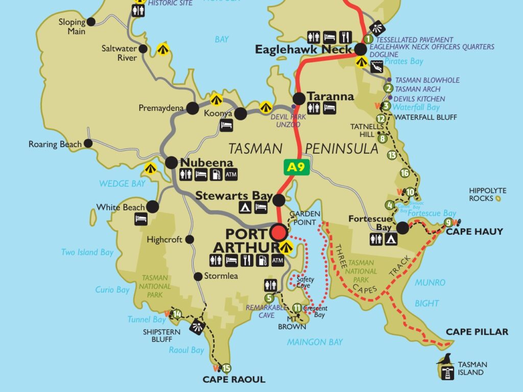
The Tasman Peninsula, located about 1.5 hours southeast of Hobart, is one of Tasmania’s most spectacular regions. It is renowned for its dramatic sea cliffs, rich convict history, and diverse wildlife. Highlights include the UNESCO World Heritage–listed Port Arthur Historic Site, stunning coastal scenery, impressive rock formations and the famous Three Capes Track. We rented a car and drove from Hobart to enjoy the sites around the peninsula.
The drive from Hobart into Tasman peninsula is actually one of the nicest scenic drives in Tasmania. There are several lookouts before you reach Port Arthur, especially if you drive via Eaglehawk Neck.
Here are the key ones in order as you drive from Hobart
- Tasman National Park Lookout
- Tessellated Pavement
- Eaglehawk Neck
- Tasman Arch and Devils Kitchen
- Blowhole and Fossil Bay Lookout
- Port Arthur Historic Site
- Remarkable Cave & Maingon Bay
- Cape Raoul viewing point
- Other amazing things to do in Tasman Peninsula
Tasman National Park Lookout – This is the first lookout you will come by on your way into the Tasman Peninsula.
Tessellated Pavement – Located at Lufra, Eaglehawk Neck, the Tessellated Pavement is a well-known coastal rock platform, naturally cracked into a grid that resembles tiles or a mosaic floor. It features two main formations – pan and loaf. Pan formations occur further from the sea, where the rock dries out more, allowing salt crystals to form and erode the surface into shallow depressions. In contrast, loaf formations are found closer to the shoreline, where the rock remains wetter, reducing salt crystallization. Instead, water and sand erode the cracks more quickly than the surface, leaving raised, block-like sections separated by deeper joints.
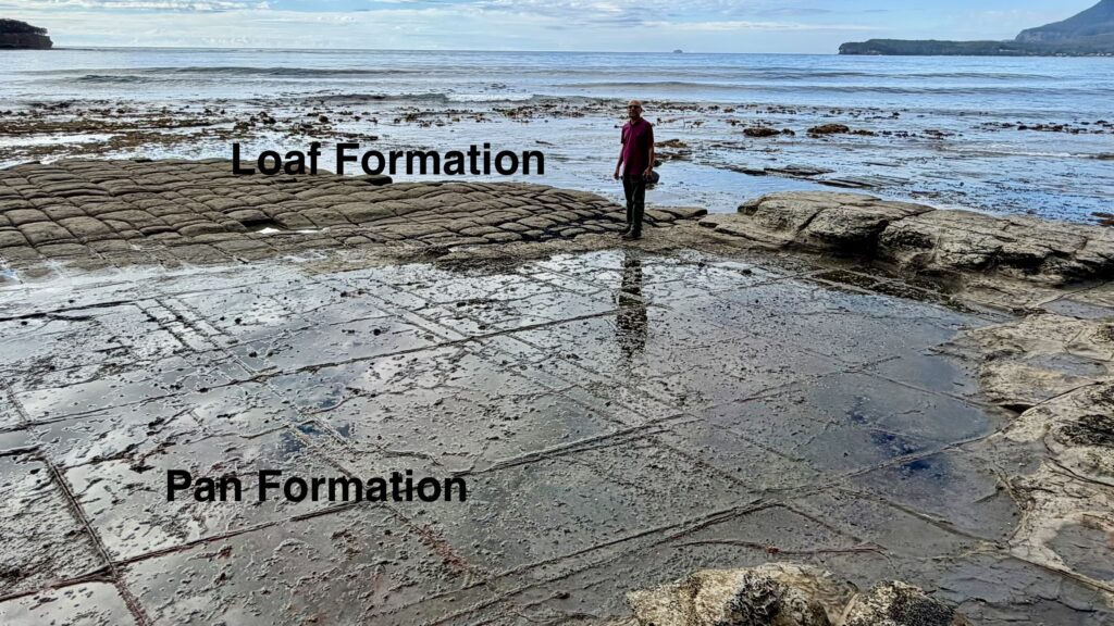
From the parking lot, a short 5–7 minute walk leads down to the shore for a close look at the patterns of the Tessellated Pavement. You can also view the pavement from above along the way, so you don’t have to walk all the way down to the shore.
Eaglehawk Neck – is a narrow strip of land connecting the Tasman Peninsula to mainland Tasmania and a historic site. It was the key to the security of the peninsula when Port Arthur opened as a penal settlement. In 1831, the Dog Line was established by the British as a security system, using a line of chained dogs to detect escaping convicts, since all escape routes from Port Arthur passed through Eaglehawk Neck. The area was heavily guarded by soldiers, and although it was considered impassable, some convicts, including Martin Cash, attempted to escape. The Dog Line remained in use until the 1870s when Port Arthur closed.
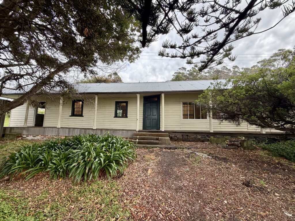
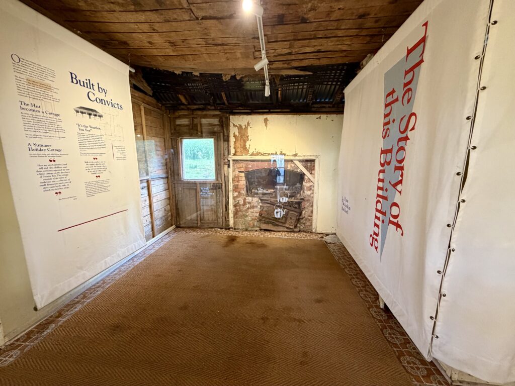
Eaglehawk Neck, Officers Quarters Museum – was first built as a 2-room hut by convicts in 1832 near the Dog Line and housed the officer in charge and the sergeant. Over time the hut was transformed into a six-room house with servant quarters and kitchen to the rear connected by a passageway. This structure is reputed to be the oldest wooden military building remaining in Australia.
Today the Officers Quarters has been restored as a museum interpreting the history and lives of convicts and officers at Eaglehawk Neck.
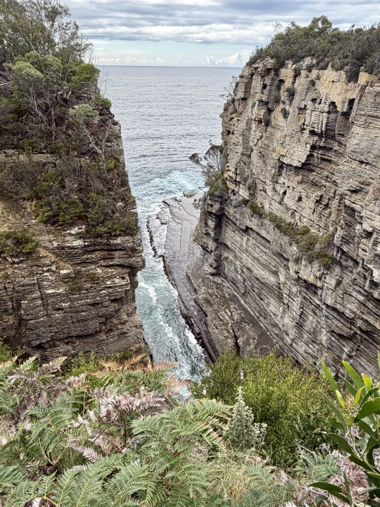
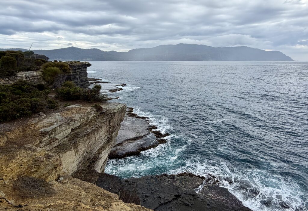
Tasman Arch and Devils Kitchen – Tasman Arch is a striking natural rock bridge formed in coastal cliffs, while Devils Kitchen is a nearby deep trench carved out by the Tasman Sea without forming an arch. Both can be viewed from easy-access lookouts near the car parks, with an optional 0.9 km loop walk offering additional perspectives, including coastal views.
Tasman Arch – This lookout is within a few meters from the parking lot. Tasman Arch is what’s left of the roof of a large sea cave or tunnel formed over thousands of years by wave action. The combined force of water pressure, compressed air, sand, and stones eroded the cliff along vertical cracks, gradually dislodging rock and leaving behind the natural arch seen today.
Devils Kitchen – The viewpoint to this highlight is within 5 minutes walking distance from Tasman Arch. Devils Kitchen is what Tasman Arch would look like without the arch, a long trench framed by steep rock walls. Waves roll in from the sea and slosh around between the cliffs.
Blowhole and Fossil Bay Lookout – From the parking lot, these lookouts are less than 5 minutes of walking. The path from the parking lot separates into two – the one on the left descends to a viewing area alongside the Blowhole. You get a great view into the tunnel carved through the cliffs. Waves roll through this dark passage and splash against the walls. The Blowhole really erupts when there are big swells. Even when the sea is calm, it is fun to watch waves roll in through the tunnel and splash up over the sides of the rocks.
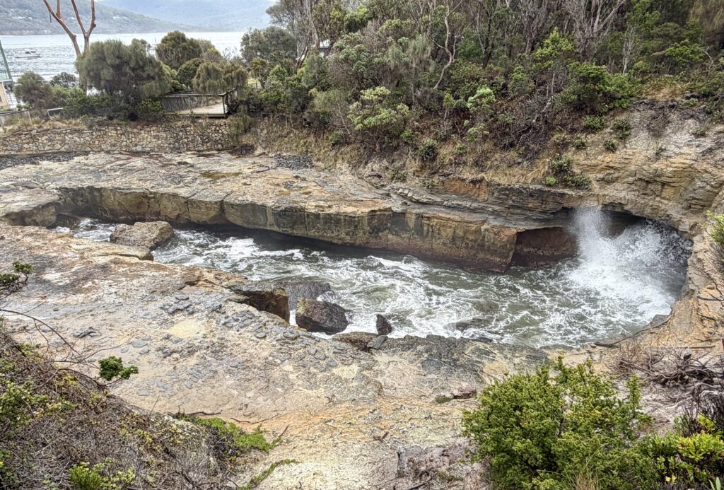
After viewing the Blowhole, you can follow a quick 3-4 minute path up to a couple of different lookouts of Fossil Bay where you will see nice views of the nearby sea cliffs and Tasman Sea.
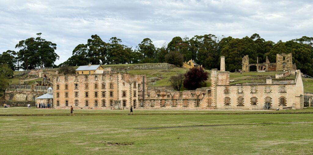
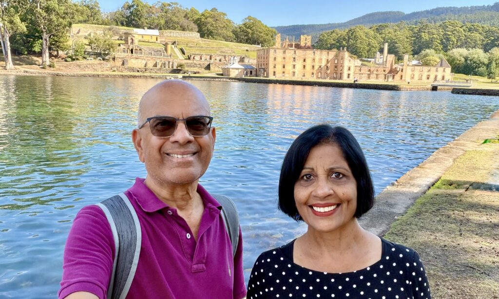
Port Arthur Historic Site – After another 30-40 minutes of driving, we finally reached Port Arthur Historic Site, a UNESCO World Heritage Site. This site was established in the 1830s as a brutal penal settlement and remains one of Australia’s most significant historic sites. Once home to many transported and repeat offenders, its remote location and harsh conditions gave it a feared reputation. Today, its 60+ buildings and scenic landscape create a powerful contrast between natural beauty and a dark past. After convict transportation ended, the site was repurposed to house invalids, paupers, and the mentally ill, and over time it underwent periods of decline, damage, and restoration. Now preserved as a major tourist attraction, it stands as one of the most vivid reminders of Australia’s colonial and convict history.
The Penitentiary is a huge four-story sandstone ruin that was originally built in 1843 as a flour mill and granary before being converted into a prison in 1857. Inside, the lower levels contained 136 small, barrel-vaulted cells for bad character convicts, designed to be isolating with minimal light, while the upper floor functioned as a large dormitory accommodating hundreds of better-behaved inmates. The building also included spaces such as a dining room, library, and chapel, all structured to enforce strict discipline and silence.
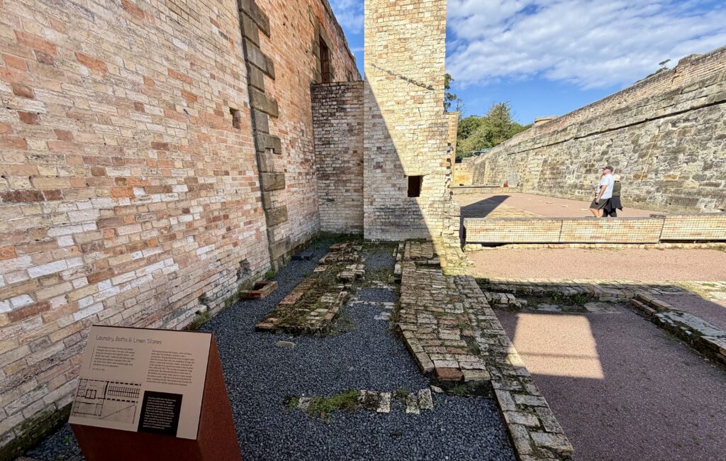
We bought the $53AUD ticket which includes – a 20-min harbour cruise, offering views of the site from the water and access to more than 30 historic buildings, ruins, restored houses, heritage gardens, and walking trails throughout the site. You can also enjoy complimentary guided talks held at key locations such as the Penitentiary, Commandant’s House, Convict Church, and Separate Prison at certain times throughout the day.
We spent more than 3 hours at the Port Arthur Historic Site exploring many of the 30+ buildings. We walked in and out of most of them and took time to read the information boards outside each structure. Some of the buildings we explored –
- Government Cottage – Built in 1853, the cottage sits prominently alongside the Church and was used to accommodate government officials visiting the penal settlement.
- The Church – began construction in 1836, with its first service held in 1837. Despite its importance, it was never officially consecrated due to disagreements between church authorities. Built largely by convicts, the church is admired today for its striking architecture and remains one of the most beautiful structures at the site, both inside and out.
- St David’s Church – is a pretty little building built in 1927 in the shadow of the ruins of the old church. This church is still part of the Anglican parish and services are held regularly and visitors are welcome to join the congregation in worship.
- Parsonage (Post Office) – was originally a 2-storey building built in 1842-3. The house gained its reputation as a haunted place during the 1870s when Reverend Hayward and his family lived here. After considerable damage to the building in 1895 bushfires, it was rebuilt as the Carnarvon Post Office.
- Accountant’s House – This house was built in 1843 to house Medical Officer responsible for the outlying probation station. It was later occupied by the officer in charge of the Commissariat stores who was known as the Accountant. After damage to the building in 1895 bushfires, much of its interior had to be rebuilt.
- The Asylum – Built in 1868, it housed patients (then known as lunatics) who came from other stations on the Peninsula. The Asylum formed a new way of thinking, aimed at curing people with mental disorders by providing a calm, pleasant, and clean environment.
- The Hospital – The first hospital was a wooden building built in 1830 below this site. The new sandstone and brick hospital was completed in 1842 and housed 6 wards, a provision store, a kitchen, a morgue, and waste collection room. Convicts and soldiers were treated in separate wards, while civilians were treated in their homes. The building was damaged in bushfires of 1895 and 1897.
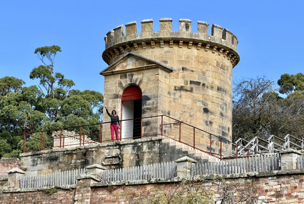
- The Guard Tower – was built in 1836 in a medieval style and served as a lookout for soldiers. From here, guards could monitor activities across the settlement and help ensure the security of the homes of the principal officers.
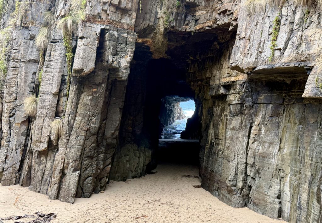
Remarkable Cave & Maingon Bay – These lookout are accessed from the same parking lot. The Remarkable cave lookout is a 15 min roundtrip walk to a cave that opens to the sea. You will have to descend the 115 steps to view the aptly named Remarkable Cave from the custom-designed platform at the base. The tunnel-shaped cave was formed through years of torment from crashing waves, eventually causing a wall of the sandstone cave to collapse and create the tunnel that stands today.
From the platform, you can only see one of the cave which resembles the map of Tasmania.
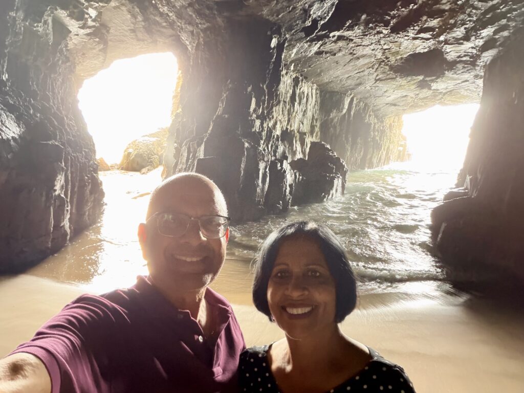
I wouldn’t recommend this approach—although we saw many people climbing over the safety railing and jumping down to the sand to enter Remarkable Cave. At the time of our visit, the waves were calm, so we felt safe enough to do the same. Walking inside, you can see two impressive tunnel-shaped cave sections, which is a unique perspective compared to the viewpoint above. However, this can be dangerous—cliffs are unstable, rocks can be loose, and waves can surge suddenly even when the sea appears calm—so caution is essential.
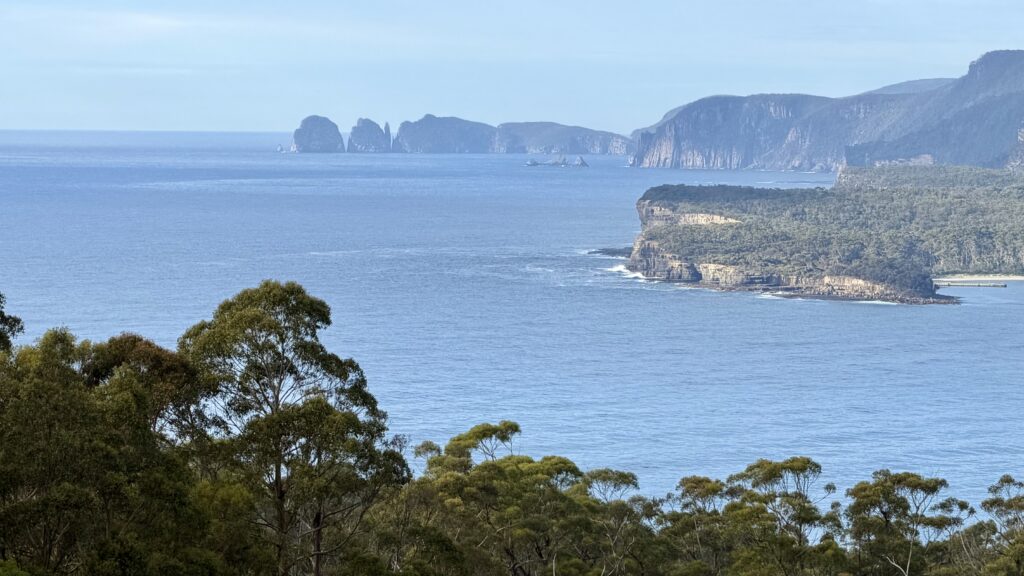
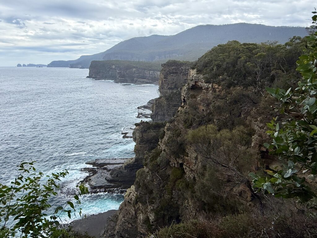
Maingon Bay – After we enjoyed Remarkable cave, we walked back to the parking lot and to the other side from where we got panoramic views of the rugged coastline, Maingon Bay, and Cape Raoul.
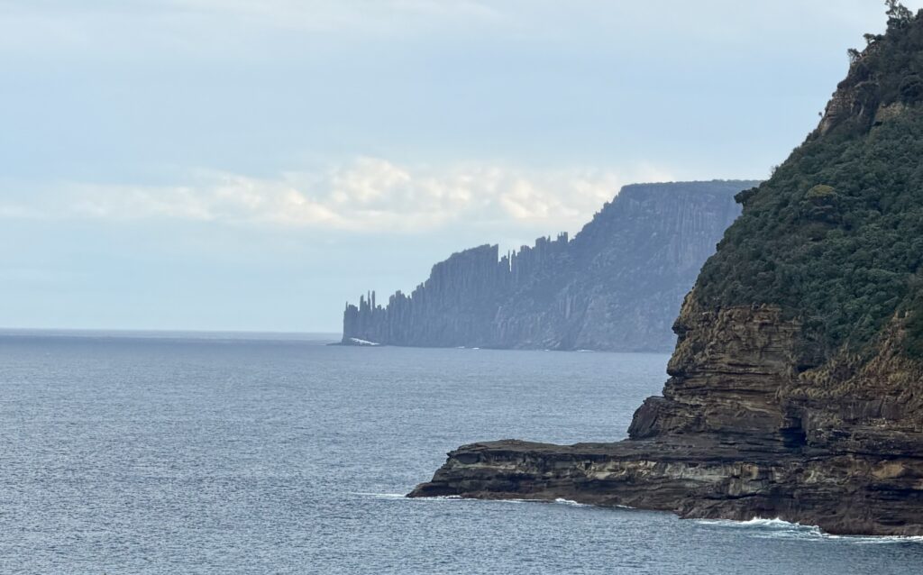
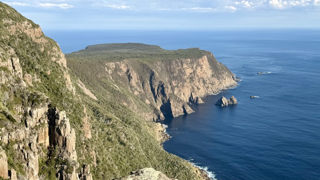
Cape Raoul Viewing Point – Cape Raoul, located in Tasman National Park, is renowned for its dramatic 200–300 meter high dolerite columns, sheer cliffs, and stunning coastal views. It is one of Tasmania’s 60 Great Short Walks, featuring a roughly 14–16 km return hike that takes about 5 hours. The area is accessible via a well-maintained track from Stormlea Road. The trailhead is on Stormlea Road, approximately a 1.5-hour drive from Hobart. The walk is ranked as a moderate hike, offering a mix of coastal forests, heathlands, and dramatic, steep cliff-edge scenery.
We only did a small percentage of this hike – walked about 1.2 miles uphill to the first viewpoint, which took a little less than an hour, and it offered beautiful scenery. The full hike continues much further to dramatic cliffs and views of the towering dolerite columns (aka Doo-Little). We’d love to return and complete the entire track in the future—it would be even more enjoyable in a group, as parts of the hike can feel quite remote and quiet for long stretches.
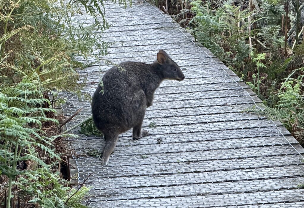
On the way back, we were fortunate to see a couple of Tasmanian Devils crossing our path.
Other amazing things to do in Tasman Peninsula –
- Tasman Island Cruise – is a great way to experience the dramatic coastline from the water. These scenic speedboat tours depart near Port Arthur Historic Site and typically last around 1.5 – 3 hours. Along the way, you can see towering sea cliffs, sea caves, and abundant wildlife, including whales (in season), albatross, seals, and even penguins.
- Tasmanian Devil Unzoo – is a unique wildlife experience located about an hour’s drive from Hobart on the way to Port Arthur. Open daily (except 25 December), it offers guided nature walks through bushland where you can come face to face with the iconic Tasmanian devils. Visitors can also hand-feed friendly forester kangaroos and encounter a variety of native wildlife, including wattlebirds, parrots, wallabies, echidnas, native fish, and many bird species. The experience lasts around 90 minutes to 2 hours, and the tour fees contribute to the conservation of the Tasmanian devil.
- Hiking & Adventure – Take on the four-day paid Three Capes Track on a guided tour which starts at Port Arthur Historic Site.
- Cape Hauy – Famous for its dramatic, narrow peninsula walk offering close-up views of the Totem Pole and Candlestick rock formations.
- Cape Raoul – Features towering 253m dolerite columns dropping vertically into the ocean. In this trip Cape Raoul is only viewed from a boat. See section above if you want to do the Cape Raoul hike.
- Cape Pillar – offers views of the highest sea cliffs in the Southern Hemisphere.
- Fortescue Bay: Known for its white sandy beach and access to the Cape Hauy and Cape Pillar walks.