2 Nights in Lobesa Boutique
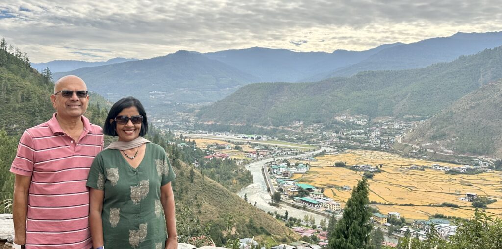
Located 72km north of Thimpu and at an elevation of 1,200m above sea level, Punakha offers a mesmerizing view of the Himalayas and is considered the winter capital of Bhutan. It also has an excellent terrain for rice cultivation as the 2 rivers – Po Chhu (Father) and Mo Chhu (mother) converge here in the valley. Punakha was the capital of Bhutan until 1955, after which Thimpu took over as the capital. The valley is an excellent place for trekking, mountain biking, and river rafting in Po Chhu river. Punakha is usually warmer than Thimpu or Paro, making it an ideal destination any time of the year.
We drove from Thimpu to Punakha on Day 3 of our trip, stopping on the way in a few places. The route is known for its breathtaking natural beauty, including lush forests, valleys, and glimpses of the Himalayas on clear days.
- Dochu la Pass
- Chimi Lhakhang
- Wangdue Phodrang Dzong
- Punakha Dzong
- Punakha Suspension Bridge
- Sangchhen Dorji Lhuendrup Lhakhang Nunnery
- Punakha Town
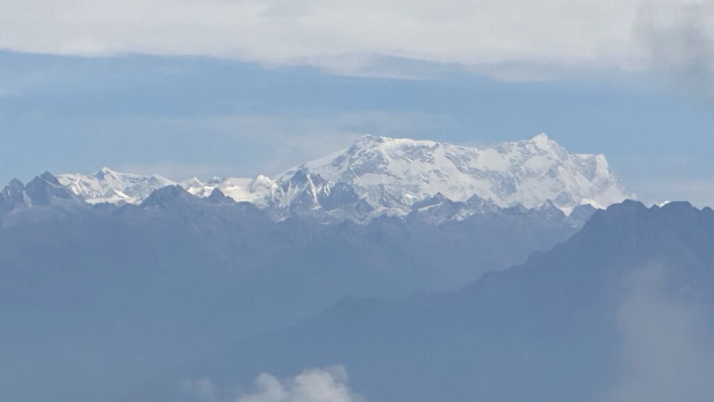
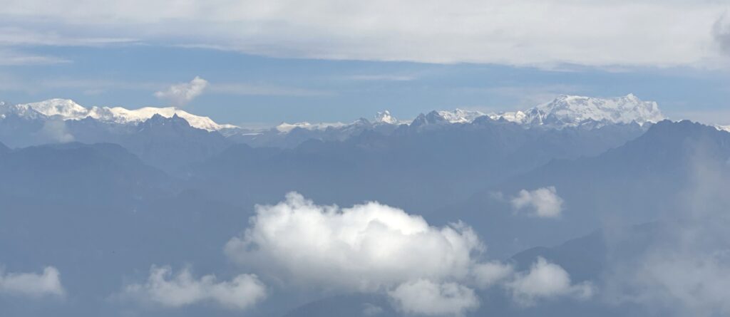
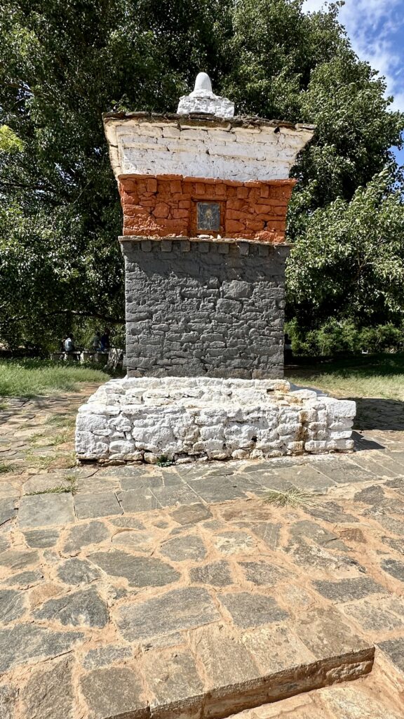
Dochu la Pass – (la means pass) is a mountain pass in the snow covered Himalayas on the road from Thimpu to Punakha where 108 memorial Chortens or stupas known as Druk Wangyal Chortens have been built by Ashi Dorji Wangmo Wangchuk, the eldest Queen Mother. Apart from the chortens there is a monastery called the Druk Wangyal Lhakhang (temple), built in honour of the fourth Druk Gyalpo (head of the state of Bhutan), Jigme Singye Wangchuck. The open grounds in its front yard is a venue for the annual Dochula Druk Wangyel Festival. You have to pay to visit the Druk Wangyal Lhakhang.
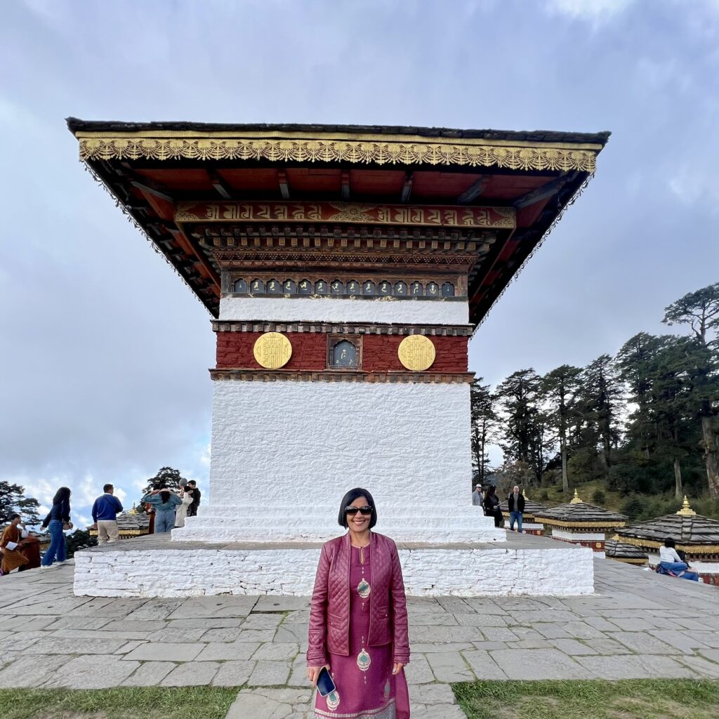
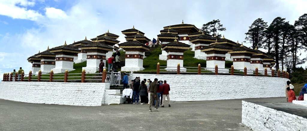
The pass is located at an elevation of 3,100m (10,200ft). To the east of the pass, the snow clad mountain peaks of the Himalayas are seen prominently and among them is the Mt. Gangkar Puensum which is the highest peak in Bhutan at an elevation of 7,570m (24,836ft). We were lucky to have a clear day to see some of the snow clad peaks.
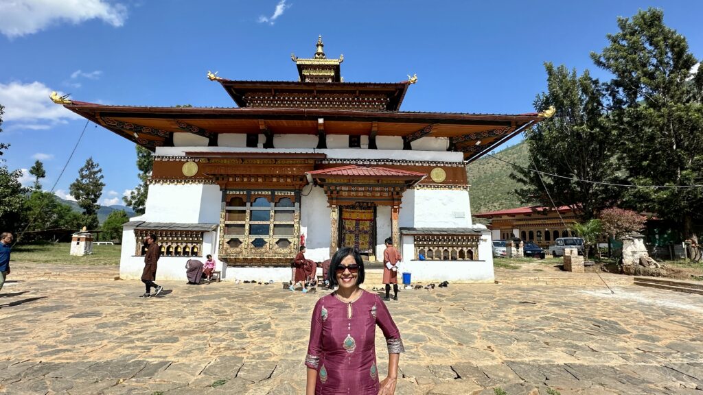
Chimi Lhakhang – Located an hour outside Punakha village, Chimi Lhakhang is a Buddhist monastery best known for its worship of the phallus. It was built in honour of Drukpa Kunley, the Divine Madman who preaches Buddhism through humor and sexual tones.
According to local lore, Drukpa Kunley subdued a demon that was terrorizing the region by wielding his Flaming Thunderbolt of Wisdom. The demon, having taken the form of a dog, was struck down by Kunley and trapped within a stupa (chorten) built on the very site of its defeat. This chorten now forms part of the Chimi Lhakhang complex, a temple renowned as the Fertility Temple, believed to bless those seeking children. The name Chimi itself is said to mean No Dog, a lasting reminder of this remarkable legend.
Inside the temple, a 10-inch wooden phallus, said to have been crafted by Drukpa Kunley himself, is used by monks to tap visitors gently on the shoulder, bestowing blessings upon couples seeking fertility. Pilgrims and travelers from around the world come to this monastery to get a glimpse of this unique side of Buddhism.
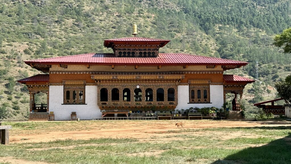
Wangdue Phodrang Dzong – Built in 1638 by Ngawang Namgyal, the Dzong dominates the town of Wangdue Phodrang. Ngawang Namgyal, also known as the Bearded Lama, was the 1st Zhabdrung Rinpoche (well respected person) and the founder of the Bhutanese state.
The Dzong is built on a ridge that looks like a sleeping elephant, overlooking the convergence of the Dang chhu and Punatsang chhu rivers. It is built in a Bhutanese architectural design and has an underground passage to be used in times of need. It also houses fourteen chapels and shrines within the Dzong.
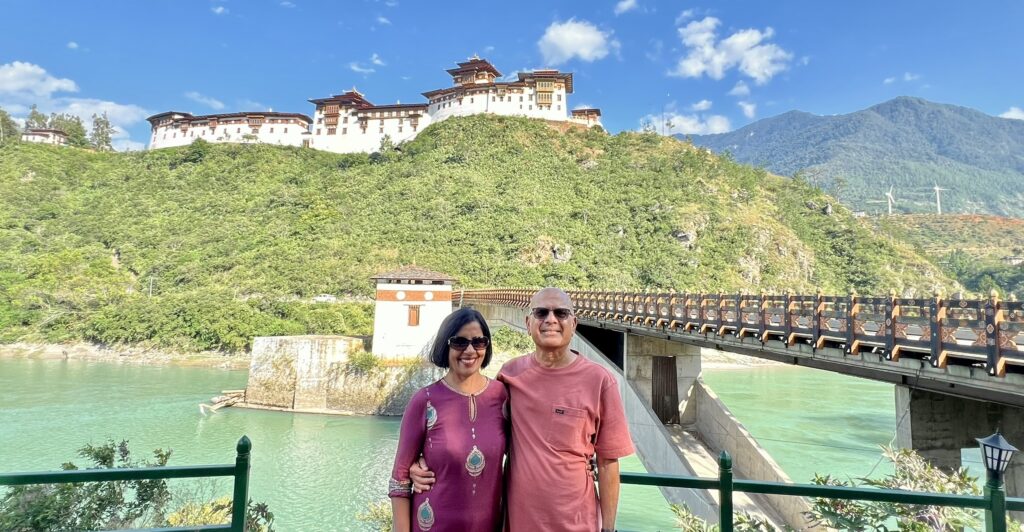
Wangdue Phodrang Dzong burnt down in 2012, supposedly because of a faulty electrical water cooker. Fortunately, the dzong was being renovated at the time, so most of the historical relics had already been put into storage and were saved from destruction. Hundreds of Japanese sympathizers donated over US$134,500 to reconstruct the Wangdue Phodrang.
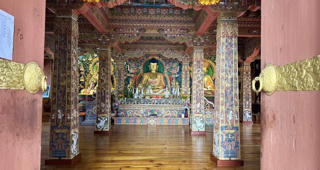
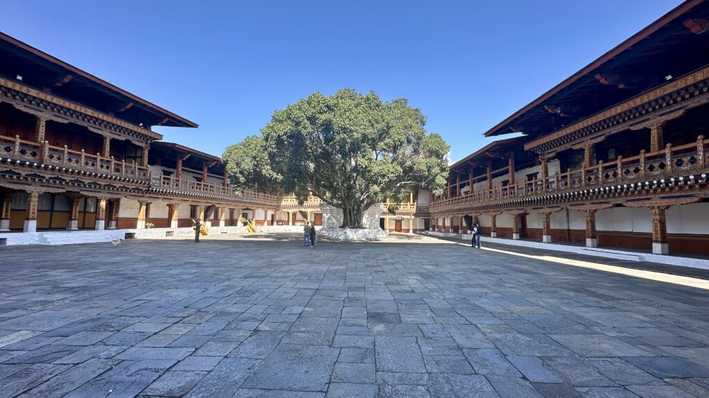
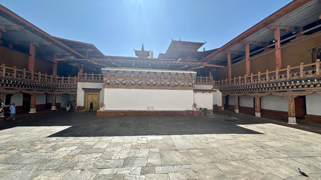
Inside the fort, there are 3 courtyards. The first courtyard is huge and has the administrative offices and is the place where events and festivals are held. The third courtyard has a beautiful shrine with a statue of Buddha.
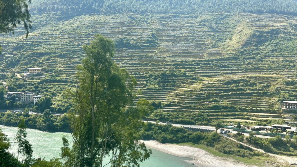
Punakha Rice Fields – The fields of Punakha Valley form one of the largest rice cultivation areas in Bhutan. Nestled between steep mountains at an elevation of around 1,200 meters, these fertile terraces are nourished by the Pho Chhu and Mo Chhu rivers. The valley is renowned for producing both red and white rice.
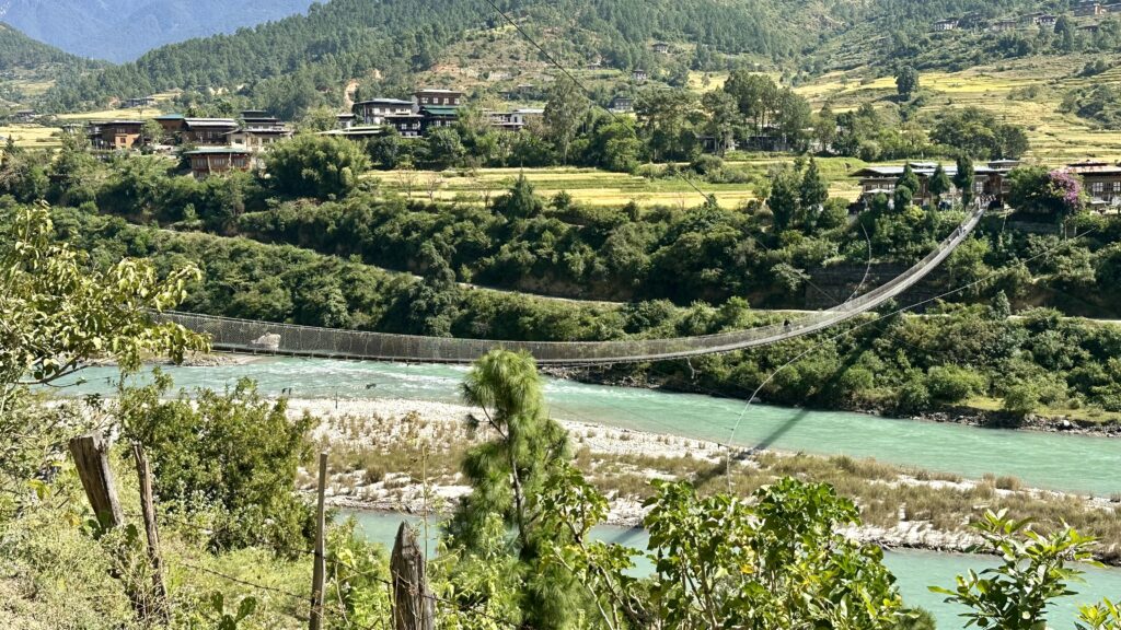
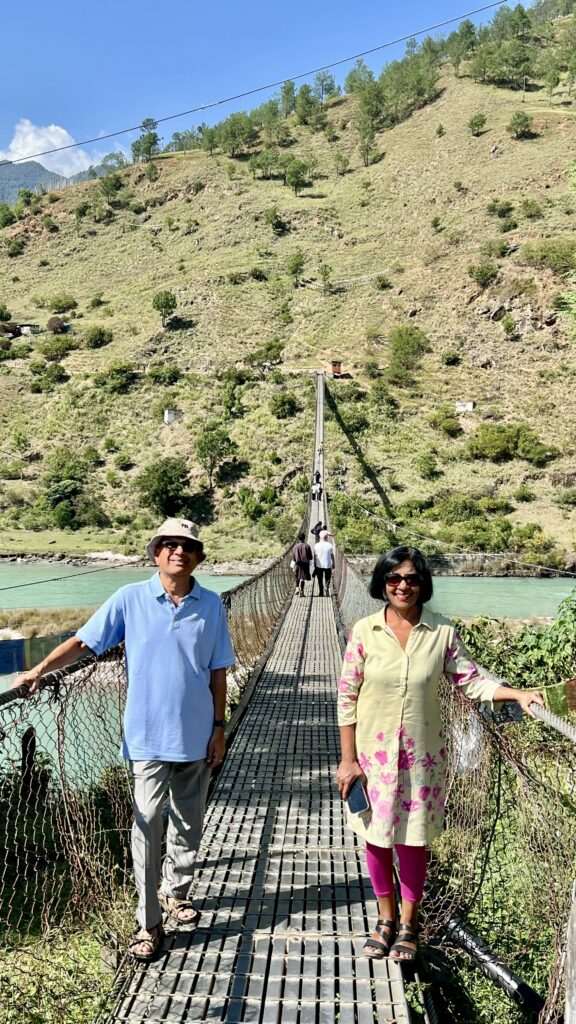
Punakha Suspension Bridge – This ancient suspension bridge dates back all the way to 1637 when Punakha was in its glory as the capital city of Bhutan. It is the longest suspension bridge in Bhutan measuring 180 m in length and has undergone several renovation over the years. The bridge was originally built to connect Punakha Dzong to the small villages on the other end of Pho Chhu river. From the bridge, you can get a spectacular view of the Po Chhu river (male river) and the valley. It’s an ideal place for a photoshoot with a stunning background. Walking across the bridge was a fun and wobbly experience.
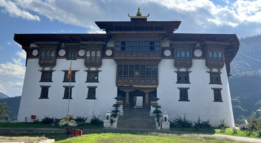
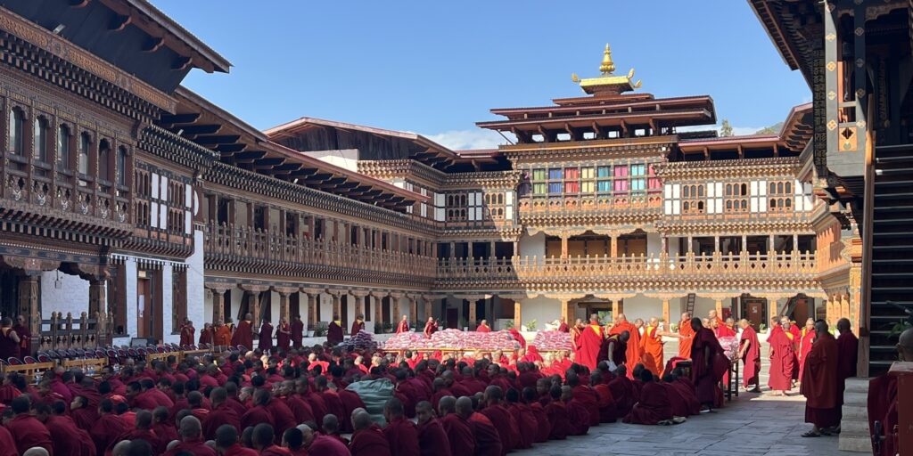
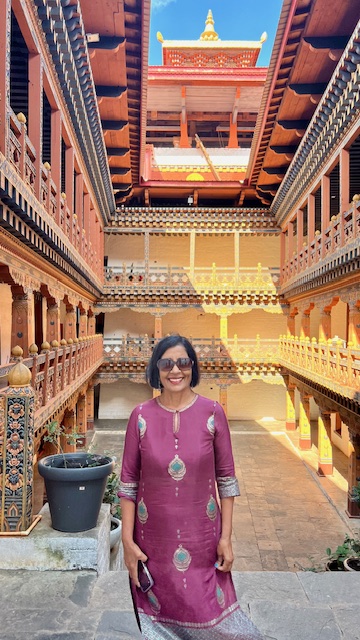
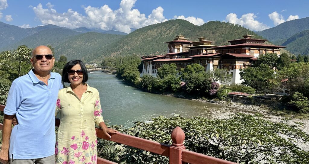
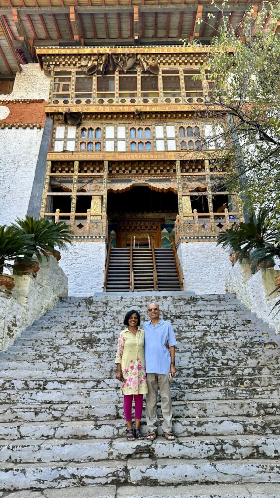
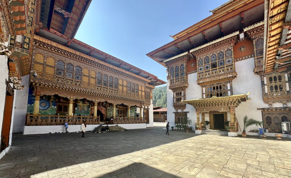
Punakha Dzong – Located at the intersection of the Pho Chhu and Mo Chhu rivers in the Punakha Valley, Punakha Dzong was constructed in 1637 by Ngawang Namgyal. It took only a year to build the Dzong and interestingly, it was built without the use of any nails. It is over 180 m long and 72 m wide having six towers surrounding it and the only way to reach the dzong is by crossing a bridge. The Dzong is the second oldest and second largest dzong in the country. It was here that the first national assembly was held in 1953 and it remained the seat of the Government of Bhutan until 1955.
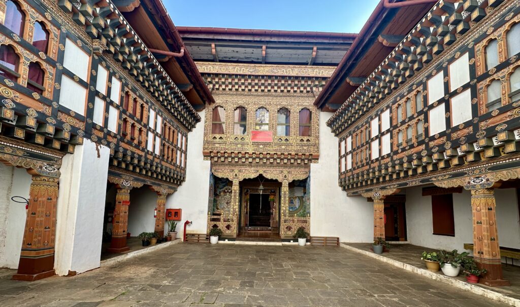
There are three sets of stairs to enter the fort, the outer sets are for the public and the central golden staircase is reserved for the Royal Family. The stairs are makeshift wooden staircase, which can be folded up in case of an attack to secure the entrance.
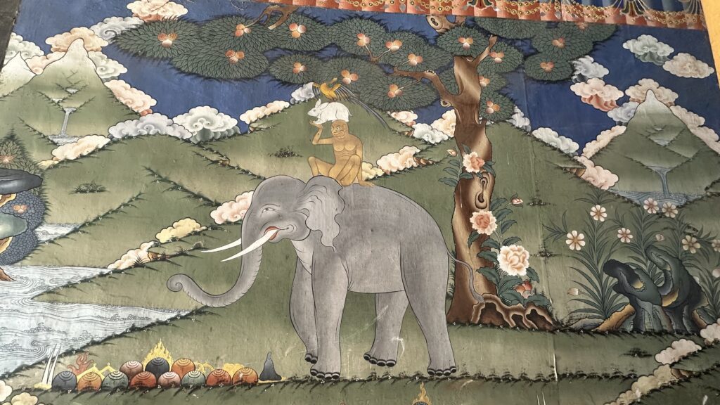
The hallway leading to the first courtyard has colorful pictures painted on the wall, one of which depicts Four Harmonious Friends or Thuenpa Puen Zhi – an image of a bird, rabbit, and monkey standing on each other’s shoulders on the back of a patient elephant portrays social and environmental harmony by emphasizing respect for nature and sustainable resource use. This story symbolizes how strength, agility, and wisdom (represented by the elephant, monkey, hare, and bird) can be combined for a common goal, like reaching fruit from a tall tree, creating a model for selfless collaboration.
Inside the fort, there are 3 courtyards. The first is huge and used for festivals and ceremonies and has a victory stupa. The third courtyard has 2 temples.
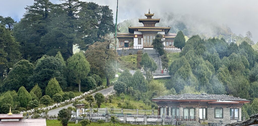
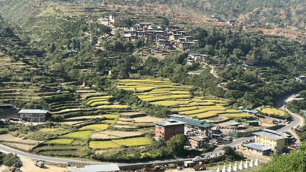
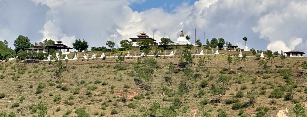
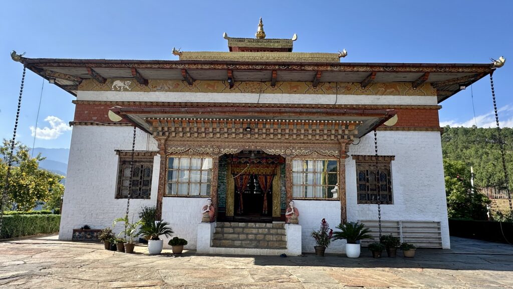
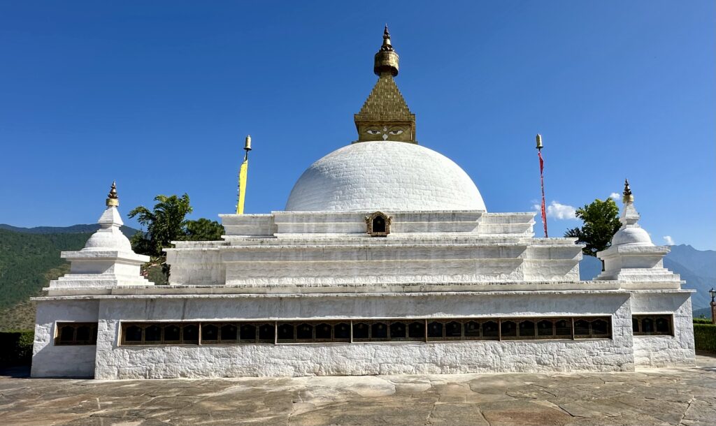
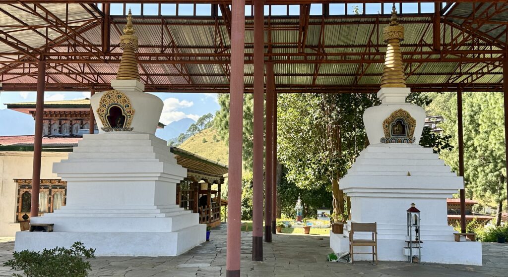
Sangchhen Dorji Lhuendrup Lhakhang Nunnery – Perched atop a hill, the Sangchhen Dorji Lhuendrup Nunnery overlooks the breathtaking valleys of Punakha and Wangdue Phodrang. We got a view of the nunnery with a row of 16 stupas from across the valley, as we were driving to Punakha.
The main temple houses a magnificent 14-foot bronze statue of Avalokiteshvara, and is accompanied by other sacred figures, including the 21 Taras, Padmasambhava, the Buddha of Longevity, and Zhabdrung Ngawang Namgyal.
The complex also features a large, semi-spherical stupa with a unique style, reminiscent of those found in Nepal and Sri Lanka. There are a few other stupas painted in white around the complex.
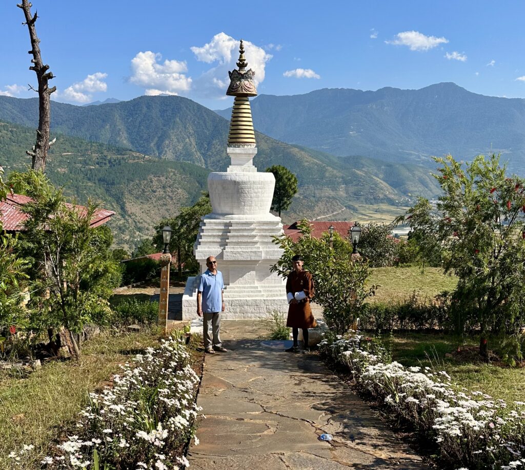
Beyond spiritual teachings, the nunnery provides vocational training in traditional Bhutanese arts such as Thangka painting, embroidery, tailoring, and sculpting, ensuring that the nuns develop essential life skills alongside their monastic education. The view from up here are breathtaking with Wangdue Phodrang on one side and town of Punakha on the other.
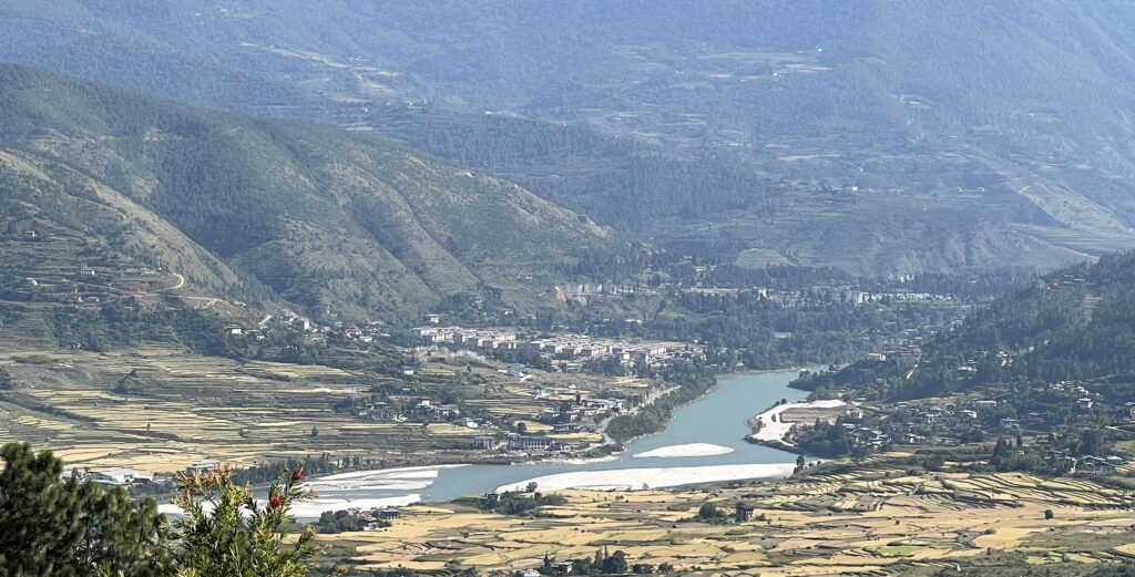
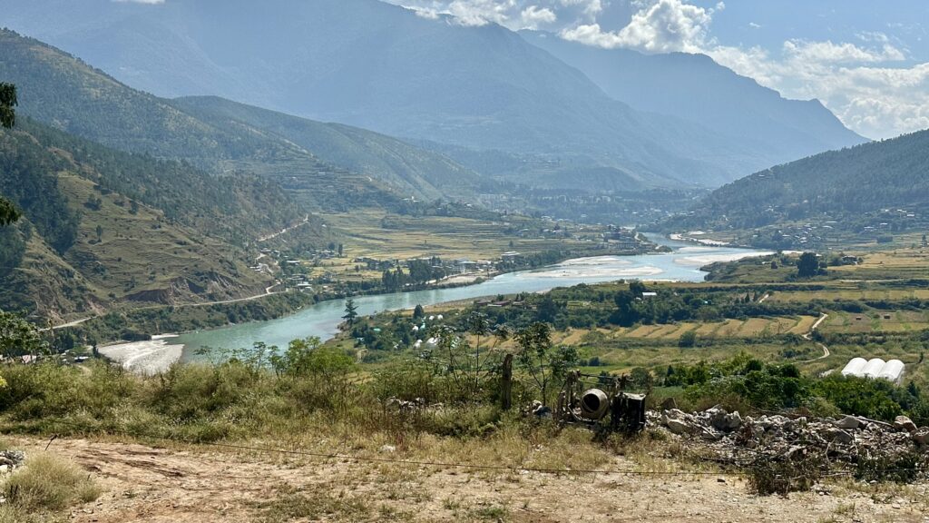
Punakha Town – Punakha felt more like a large village, centered around a single main street. The river Puna Tsang Chhu (Punakha River) flows through the city. The Punakha river is formed by the confluence of Mo Chhu and Po Chhu rivers at a meeting point below the Punakha Dzong.
We had lunch at a small corner restaurant — the food was decent, though nothing remarkable.
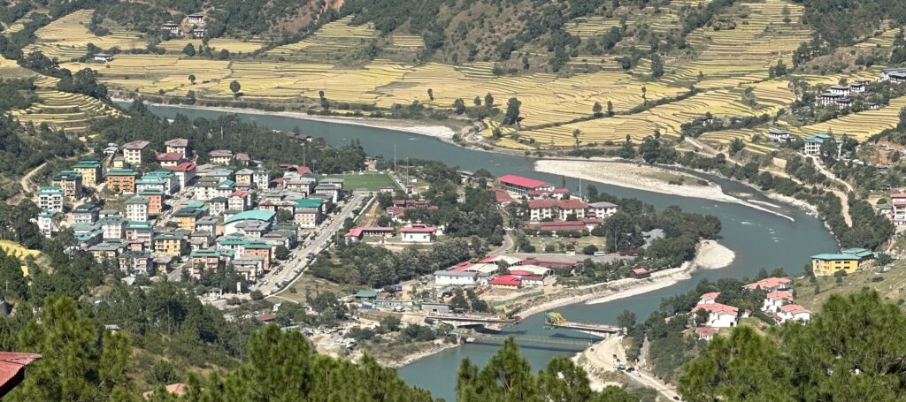
We stopped on the drive down from Sangchhen Dorji Lhuendrup Lhakhang Nunnery, at a viewpoint that provided view of the town of Punakha from a different angle.