Spread across 21 counties of eastern Kentucky, the Daniel Boone National Forest manages more than 708,000 acres of national forest system lands within a 2.1 million-acre proclamation boundary. It offers a wide array of outdoor activities like boating, hiking, rock climbing, and swimming in the lakes, rivers, and streams. Additionally, the forest features many waterfalls including Kentucky’s biggest waterfall – Cumberland Falls.
- Cumberland Falls
- Natural Arch
- Dog Slaughter Falls
- Flat Lick Falls
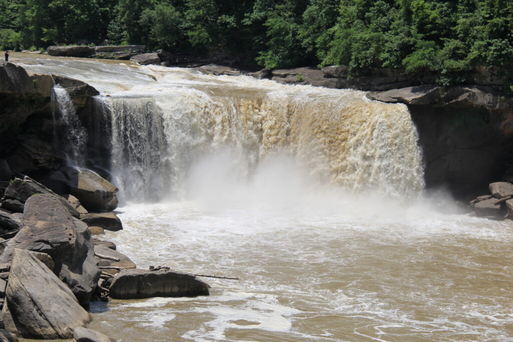
Cumberland Falls – Often called the ‘Niagara of the South,’ Cumberland Falls stretches 125 feet wide. From the visitors parking lot, it is a short quarter mile walk to the Falls Overlook. There are a few other viewing spots which involves climbing up/down a few steps.

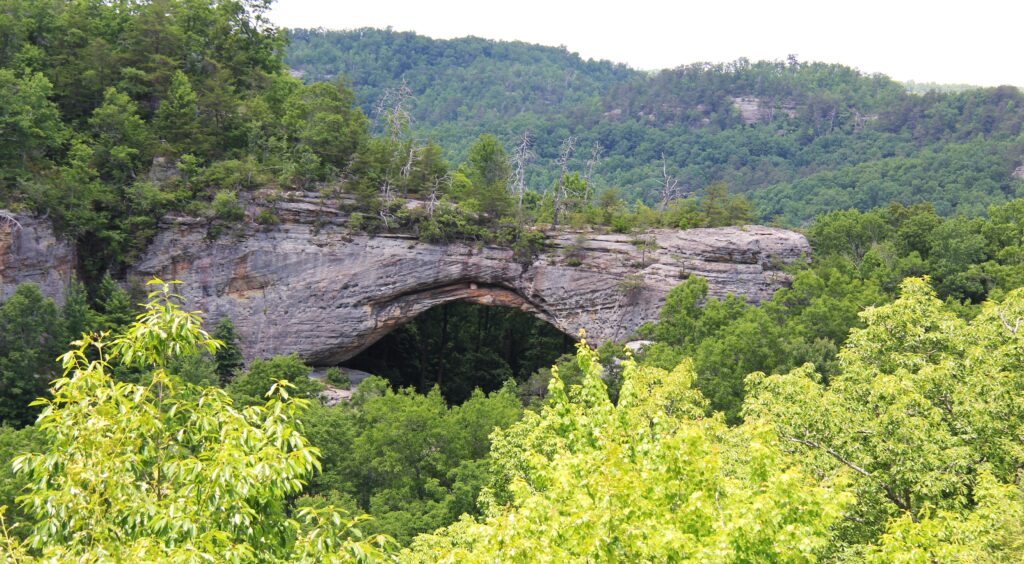
Hiking to the Natural Arch – Natural Arch Loop is a 1.4 mile moderately trafficked loop trail located near Parkers Lake. The trail begins at the parking area of Natural Arch Scenic Area and runs along a paved pathway to the base of the arch. The trail passes two scenic overlooks. At the arch, you may climb the steps to the arch and continue along a dirt pathway that loops around the northwest end of the arch. Trail #508 intersects at your right. Follow Trail #510 around the cliff line and you will return to the base of the arch.


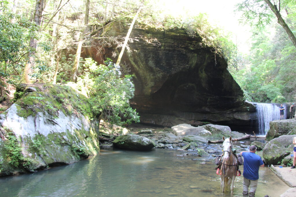
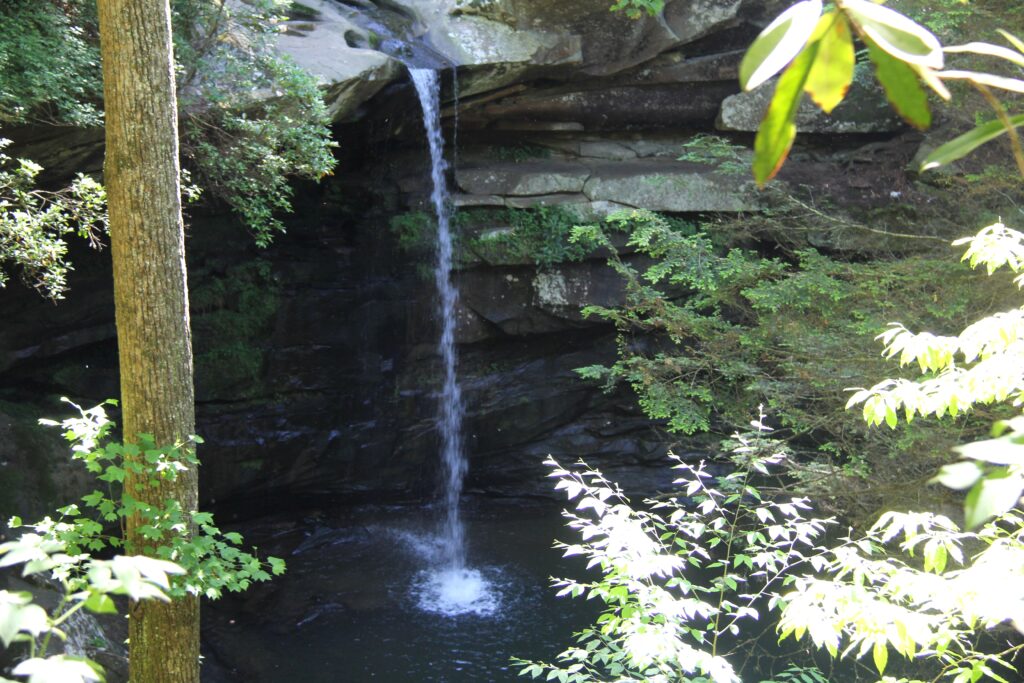
Dog Slaughter Falls – The trail to this falls is a 2.6 mile heavily trafficked loop that is moderately challenging. The water falls from a height of 15 feet.
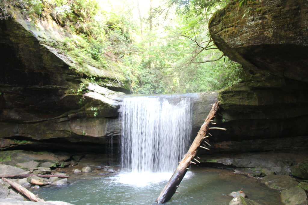
The area around Dog Slaughter Falls is known for its scenic beauty and the beautiful blue plunge pool that forms at the base of the falls. This pool is a popular swimming hole for hikers and visitors to the area.
There are a couple of stories behind the name of the falls – either it refers to the drowning of unwanted pets or the loss of hunting dogs to wildlife.
Flat Lick Falls – The trail leading to this falls is a 0.6 mile heavily trafficked loop and is rated as moderate. There was not much water falling here on the day we visited.
Here are a few more waterfalls that you can hike to if you have time. Eagle Falls is within hiking distance of Cumberland Falls. You have to drive to Honeymoon and Yahoo falls.
Eagle Falls – Trail is a 1.8 mile heavily trafficked loop trail that features a waterfall and is moderately difficult. This trail involves stairs and some scrambling is required but the hike is worth it, with scenic views of Cumberland Falls and the river.
Honeymoon Falls – Not just for lovers, Honeymoon Falls is a popular hike in Pine Mountain State Park in southeastern Kentucky near Pineville. This is a short but intense hike, gaining 350 feet in elevation in less than 1.5 miles. This is 58 miles east of Daniel Boone National Forest.
Yahoo Falls – Kentucky’s tallest waterfall at 113 feet. Located in the northern unit of the Big South Fork National Recreation Area near Whitley City, the falls are near the Sheltowee Trace National Recreation Trail. A shorter 1.2-mile route takes off near the Yahoo Falls Scenic Area parking lot, but you’ll have to descend more than 200 steep metal steps from this path. This is 20 miles west of Cumberland Falls