2 Nights in Alplodge Interlaken
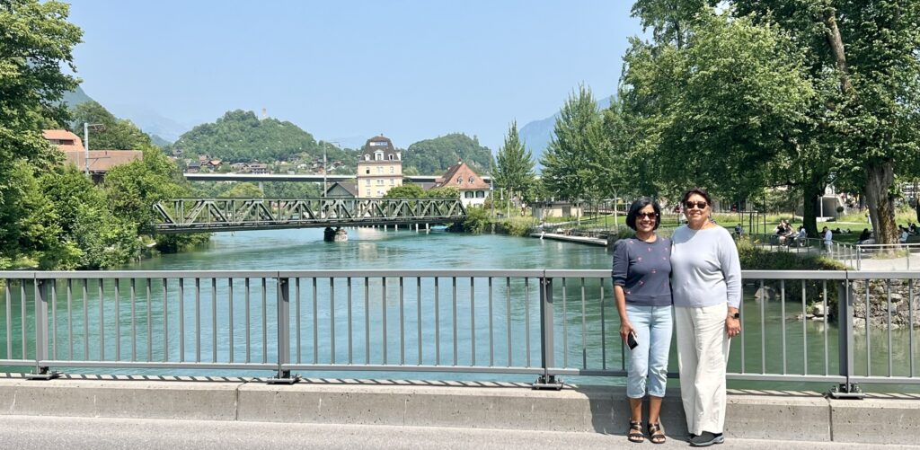
Interlaken is a gorgeous tourist destination in the Bernese Oberland (or highland) region of the Swiss Alps. The town is located on flat land between two lakes, Brienz to the east and Thun to the west, and alongside the river Aare, which flows between them. We reached Interlaken from Zermatt on the evening of Day 8 of our Switzerland trip (train route was Zermatt-Visp-Spiez-Interlaken which took about 2h:30m).
Interlaken is divided into 2 areas – Interlaken Ost(East) and Interlaken West.
- Interlaken Ost (East) – Located close to Lake Brienz and the starting point to popular destinations like the Jungfraujoch (Top of Europe), Grindelwald, and Lauterbrunnen.
- Interlaken West – Situated closer to the center of Interlaken and attractions around Lake Thun – This is where we stayed
- Getting between the two – Train takes 3-4 minutes; Bus takes 6-8 min; Walk – 1 mile (20-30 min).
- Many hotels are conveniently located near either station.
Sites around Interlaken –
- Panoramabrücke Sigriswil (Sigriswil Panorama Bridge)
- St. Beatus Cave and Waterfalls
- Harder Kulm funicular
- Lake Thun and Lake Brienz
- Ballenberg, Swiss Open-Air Museum
- Giessbach Falls
- Jungfraujoch, The top of Europe – We skipped this
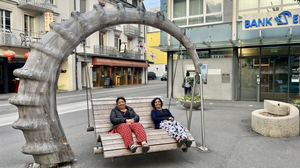
As we walked around the town looking for a place to eat, we passed by a really cute wooden photo worthy swing, where.
One of the things we found interesting in all the cities we visited in Swizerland – there were at least 3-4 Indian restaurants within walking distance of our hotel. In Lucerne and Interlaken, there was one across from our hotel. Tonight though, we settled for pizza.
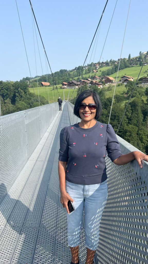
Panoramabrücke Sigriswil (Sigriswil Panorama Bridge) – To visit this place from Interlaken West –
- Take bus 21 to Guten Dorf
- then transfer to bus 25 which will drop you off at Sigriswil Dorf
- The ticket counter is a 3 min walk from the bus stop – 6 CHF to walk across the bridge.
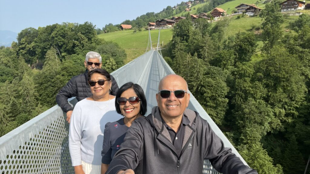
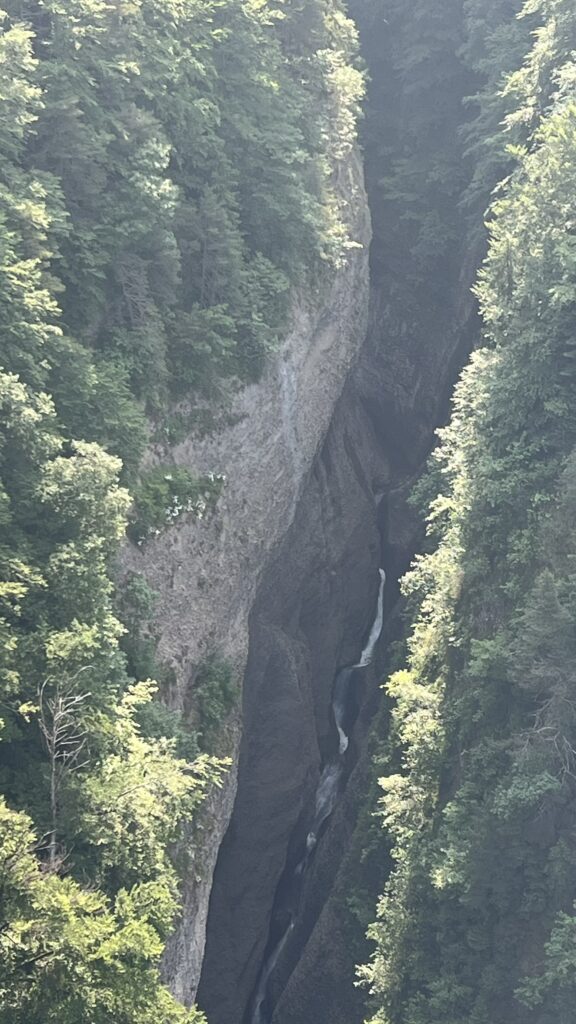
This suspension bridge is 340 m long and connects the villages of Sigriswil and Aeschlen and also offers a magnificent view of the famous Bernese Oberland peaks, the Eiger, Mönch, Jungfrau, as well as Lake Thun. The bridge also crosses the 182m deep Gummischlucht gorge. We spent an hour here walking up and down the bridge, taking pictures, enjoying the view around. While on the bridge, we were not able to identify the Eiger, Mönch, and Jungfrau as it was not a clear day.
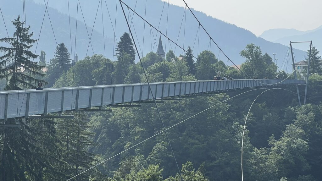
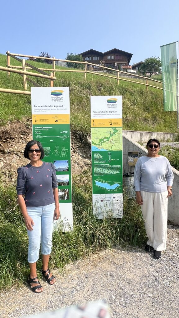
This Panoramic Bridge between Sigriswil and Aeschlen is one of a total of three suspension bridges on the Lake Thun Panoramic Circular Trail. The popular 56 km long circular hike connects various mountain and shoreline paths around the lake.
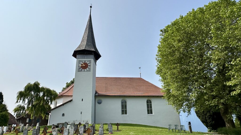
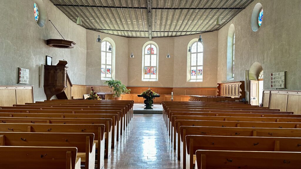
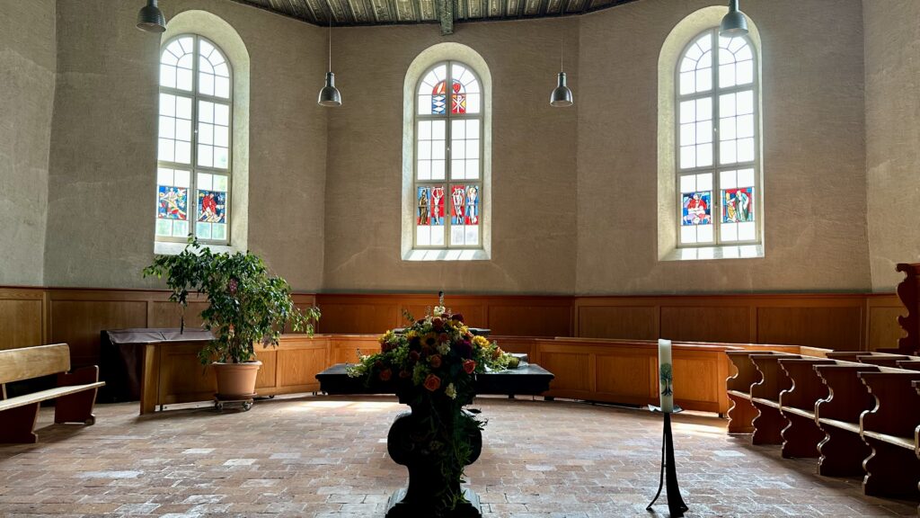
While waiting for the bus in Sigriswil bus stop to get back to Interlaken, I visited the cute church near the bus top.
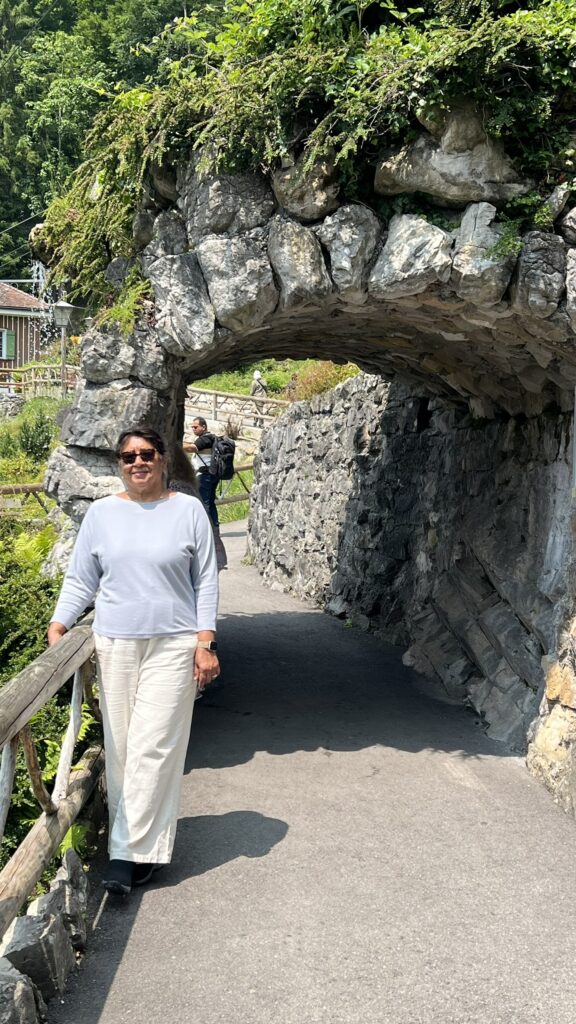
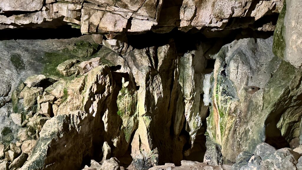
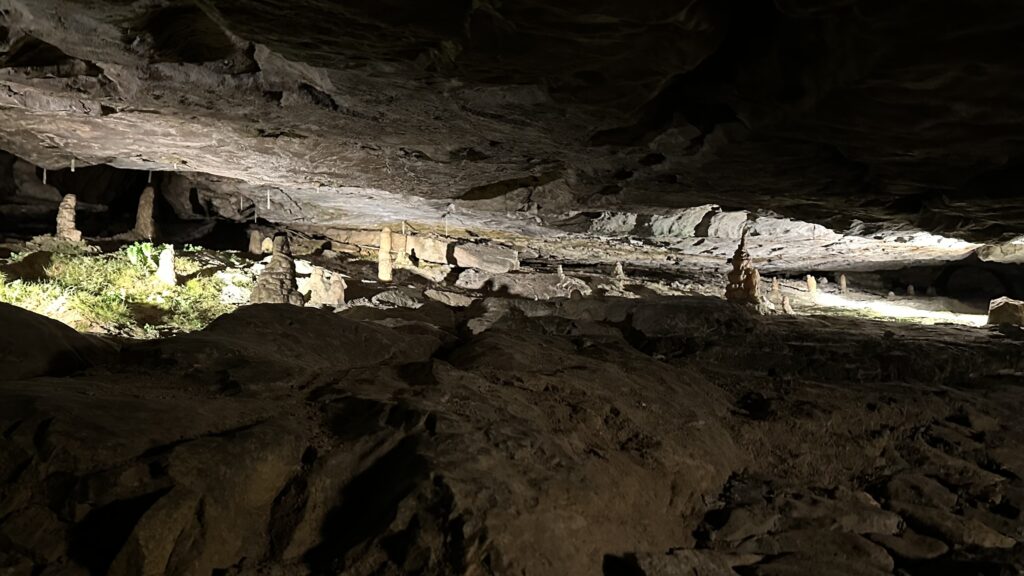
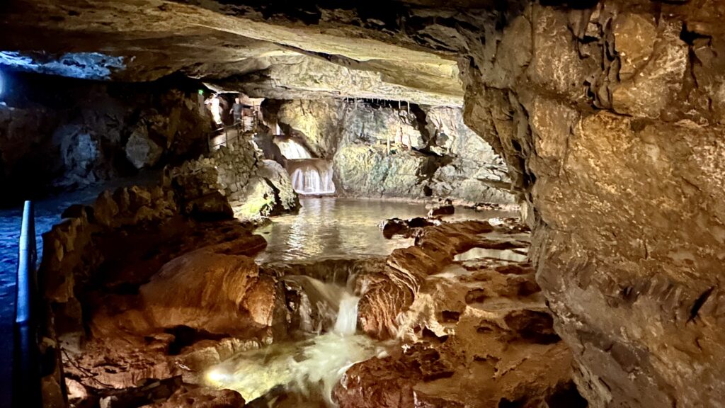
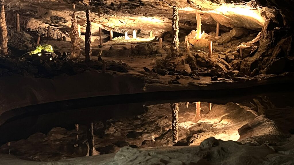
St. Beatus Cave and Waterfalls – These caves were on the way back from Sigriswil. We got back on Bus #25 and got off at the Beatus Cave bus stop. You can see the entire area from the bus stop across the road. It is quite beautiful, with a series of waterfalls cascading down the cliffs.
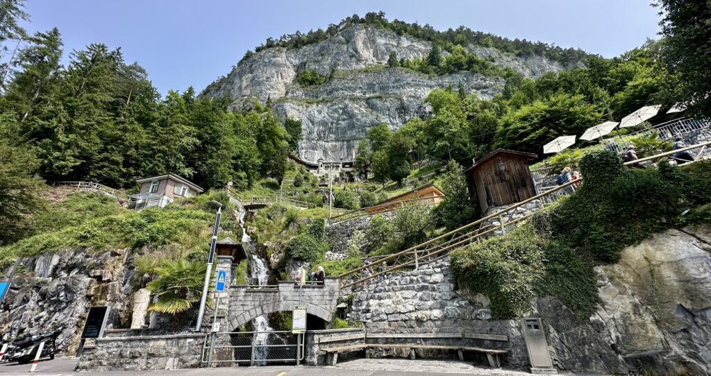
Lots of walking involved here. We had to first walk uphill for about half a mile to reach the cave entrance at the top. As we walked up, we enjoyed views of the lake and the waterfall.
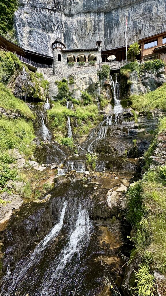
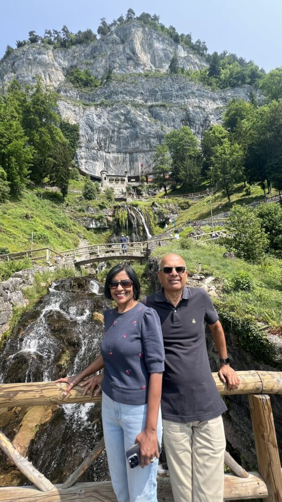
At the top, you can buy the tickets which cost about 20 CHF (Swiss Travel Pass does not cover this attraction). Once inside the cave, it is a 1-2 km walk through chambers and passageways. There are some steps to climb as well. The round trip inside the cave will take 45-60min. We did a self tour, which is more than enough and overall it was an ok experience. If you have been to Luray Caverns in Virginia, you will be disappointed with this one. Don’t go with expectations of seeing beautiful stalactites and stalagmites.
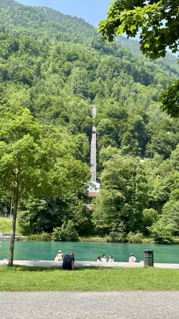
Interlaken Ost – After visiting St. Beatus, we took a bus to Interlaken Ost. The city center is close to the train and bus station and has a number of restaurants lining the main street. We had lunch at the Indian Village restaurant. After lunch, we walked over to the Harder Kulm funicular station which was a 5 minute walk, across a bridge over the Aare river.
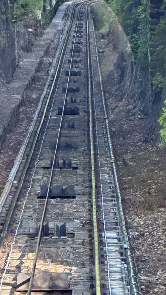
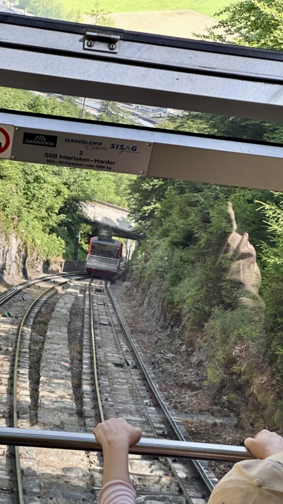
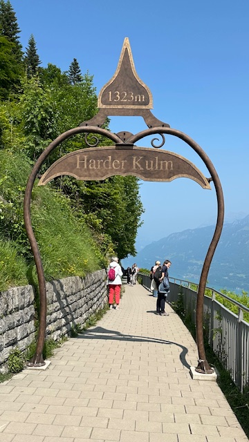
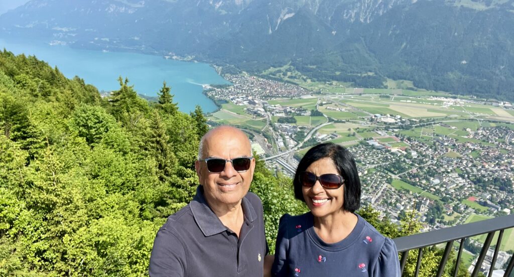
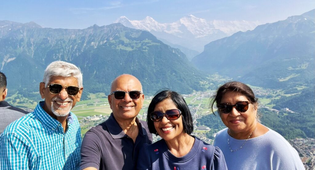
Harder Kulm – is a 1,322-m mountain that overlooks Interlaken town and its sparkling lakes. In order to visit the top, you can take a 10 min ride on a century-old funicular to Harder Kulm station. The funicular is in the town of Interlaken Ost, just a 5 min train ride from Interlaken West. From the train or bus station it is just a 3-5 min walk to the funicular ticket counter. With Swiss Travel Pass, tickets are half prized and cost 22 CHF/adult. The funicular runs every 20 minutes. On the day and time we visited, the line to get onto the funicular was long and we had to wait for close to 30 minutes to get on. The ride to the top is only 10 min long.
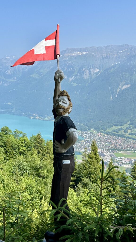
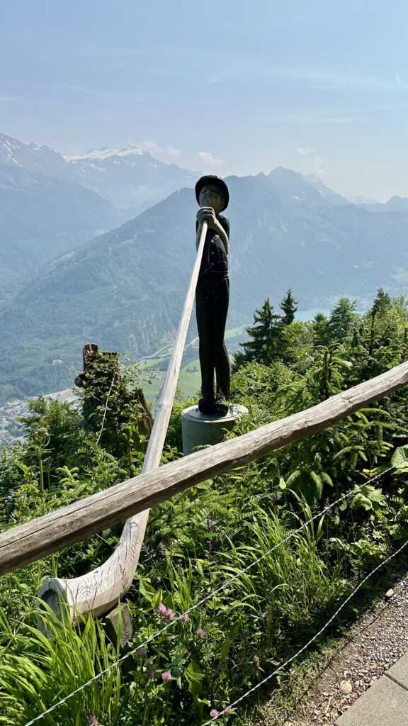
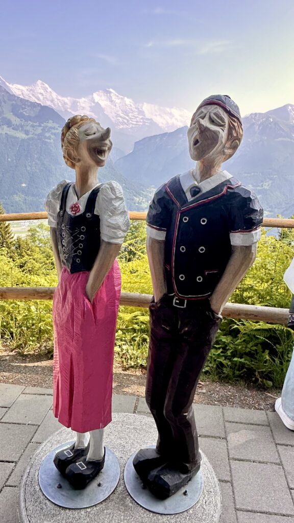
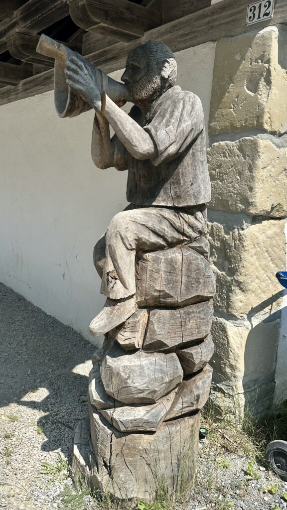
At the top, you follow a well paved path towards the viewing platform. Along the walkway, watchout for unusual wooden statues of people waving the Swiss flag or singing.
After less that half a mile of walking, the path will lead you past the Harder Kulm metal arch and the Harder Kulm Restaurant, to a viewing platform that juts out off a cliff. From here you can look down upon Lake Brienz and Lake Thun, or admire the Eiger, Mönch, and Jungfrau.
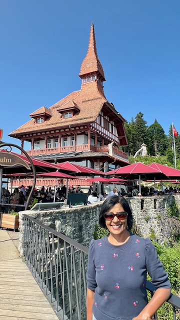
If you’re feeling energetic and want to go for a hike, there are some hiking paths here, like the hour-long Harder Kulm Circular Path. We spent about 30-45 minutes near and around the restaurant enjoying the view and taking some selfies. We then walked back to the station and then took the funicular down.
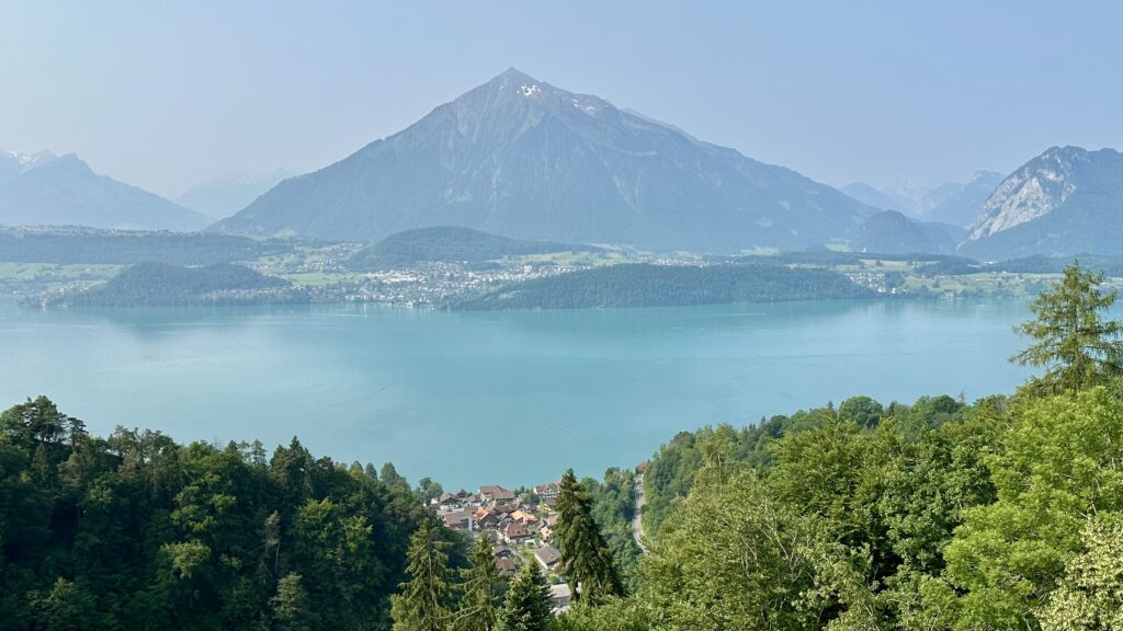
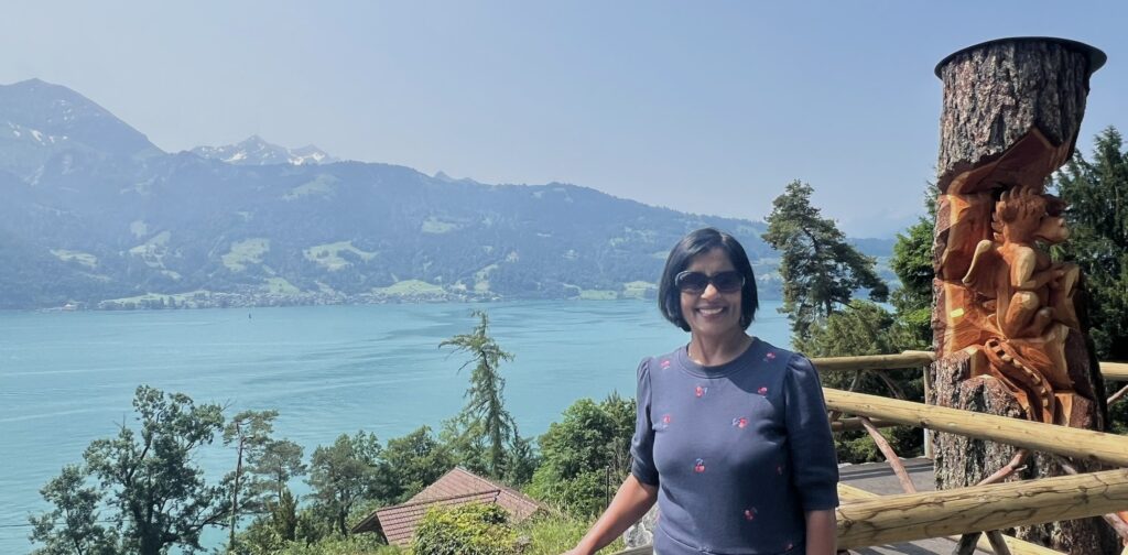
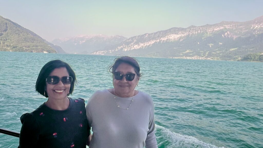
Cruising on Lake Thun – On the west side of Interlaken is Lake Thun, a long, narrow lake surrounded by mountains. On Interlaken’s east side is Lake Brienz, a narrow body of water that’s really an enlargement of the valley of the River Aare. The best way to explore the lakes is on one of the cruise boats. The Swiss Travel pass allows you to travel free on the cruise boats. We took a bus back to Interlaken west, and took a cruise on Thun Lake.
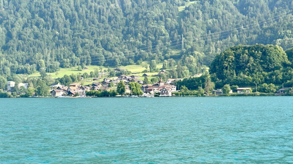
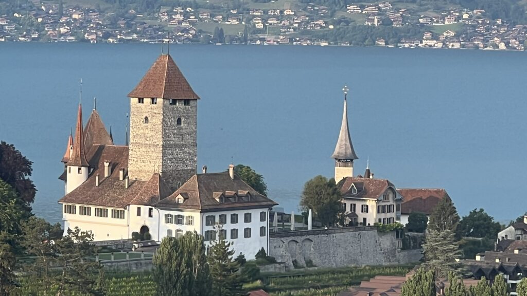
We got off at the town of Spiez which is located on the shores of Lake Thun. We walked around the small but picturesque town. The castle of Spiez is a highlight of the place and you get a great view of this castle and the lake from the train station.
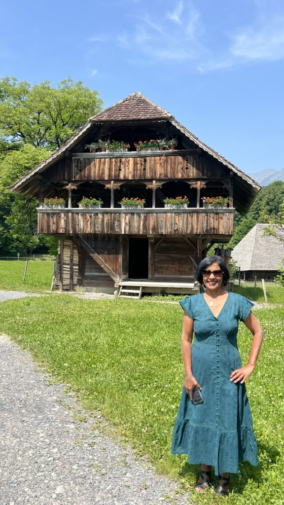
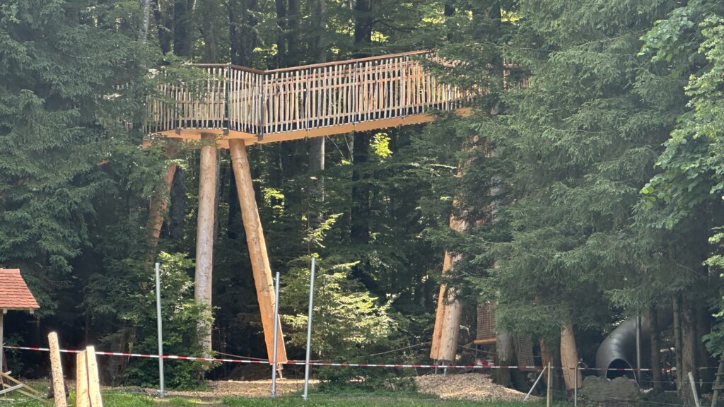
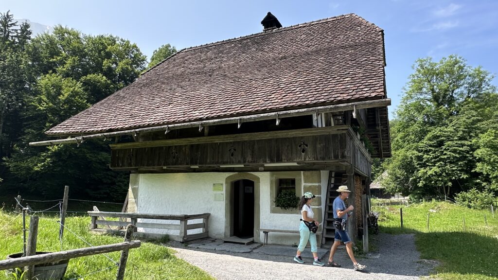
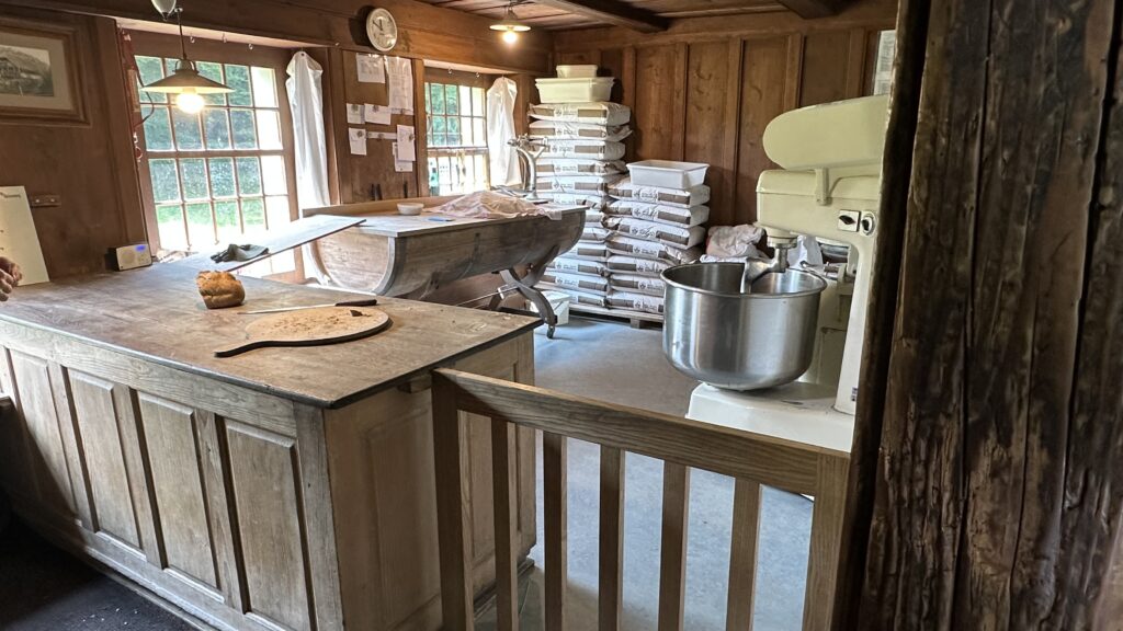
Ballenberg, Swiss Open-Air Museum – The next day morning, we decided to visit Ballenberg Open-Air Museum which was just a bus ride away from Interlaken. It is also free to visit with Swiss Travel Pass. Unpaved roads and stone paths lead you from the entrance to the various centuries-old buildings from every part of Switzerland.
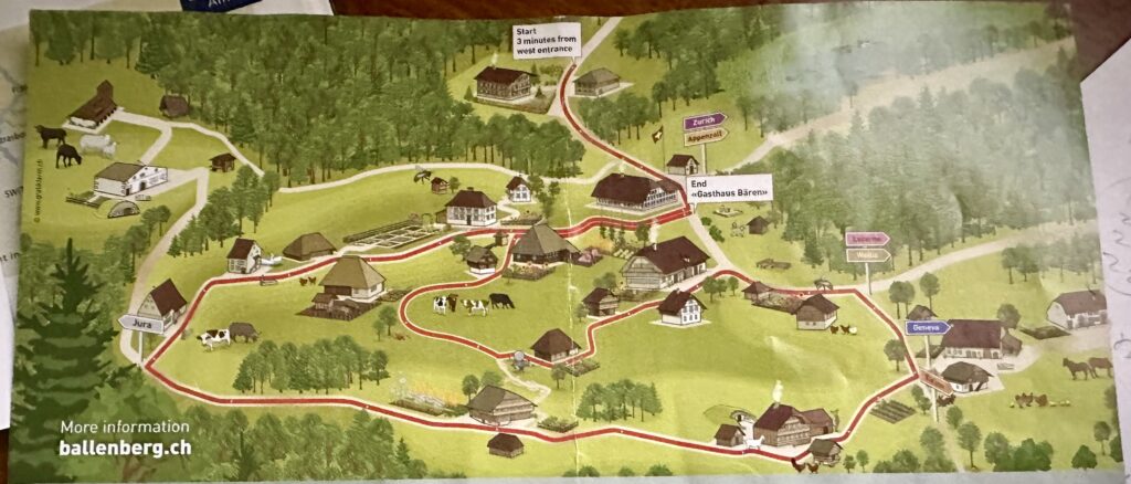
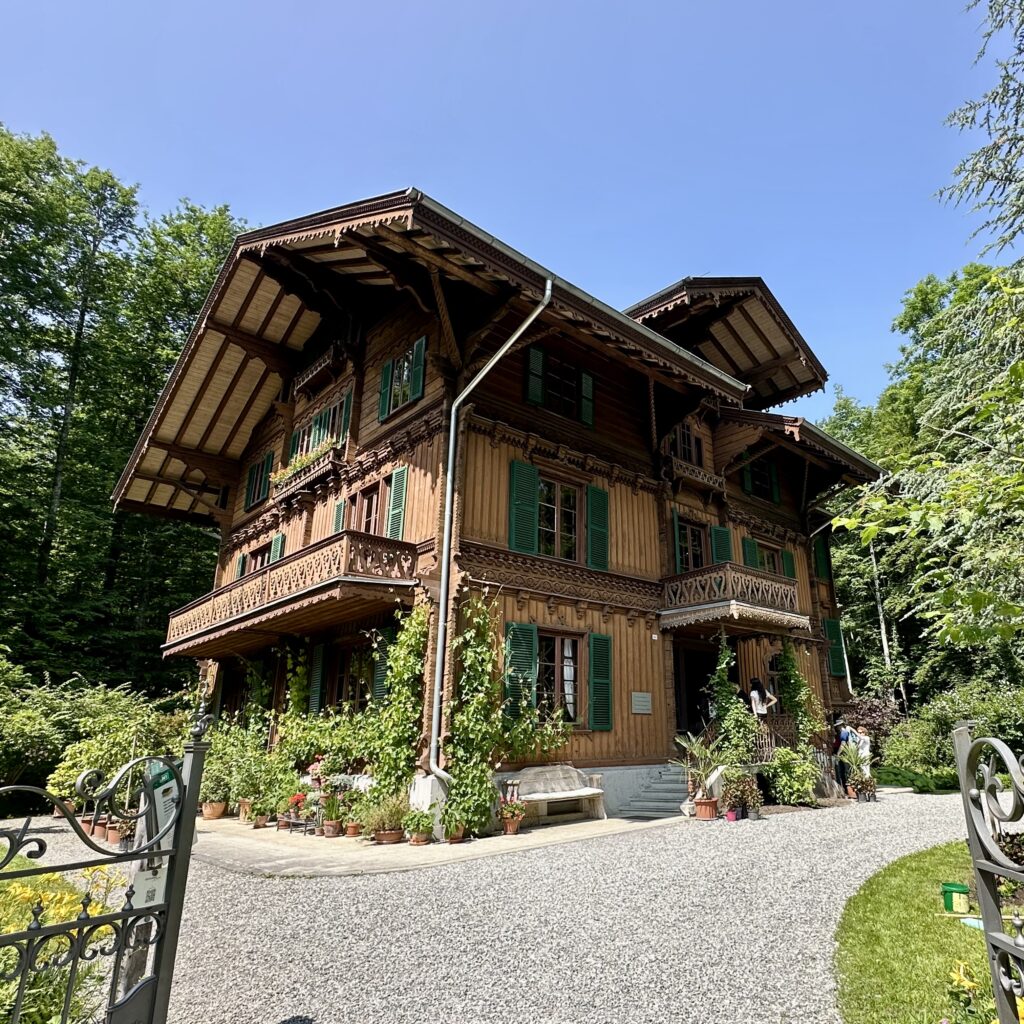
You will have to spend at least 3 hours to cover the important buildings as they are quite spread out. If you spend half a day or more, you can see demonstrations of woodcarving, basket weaving etc. We got a bit bored after walking for an hour and decided to leave. Whatever we saw during the hour was nice. The first building we came across was Industrialist’s Villa. Built in 1872, the house from Burgdorf is a high class villa where textile magnate Hans Schafroth and his family lived.
Other buildings and sites as we walked further in –
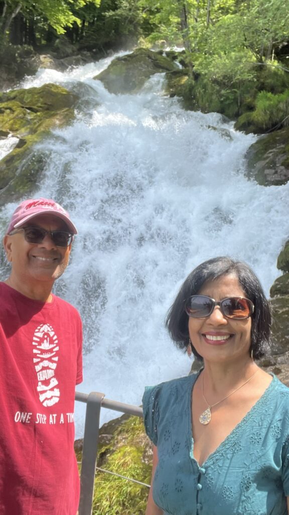
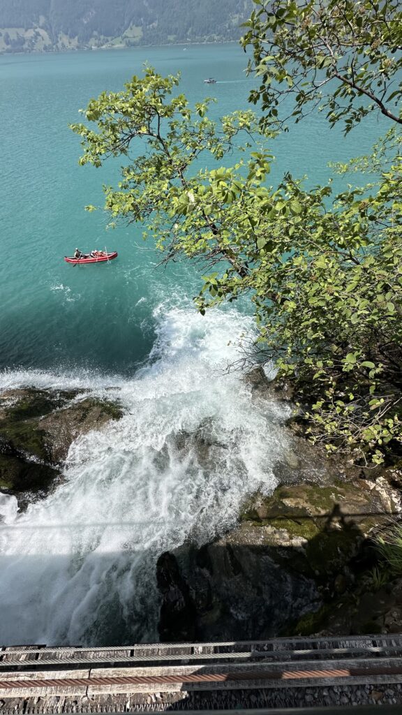
Giessbach Falls – This majestic falls plunges down from a height of 500m in a series of 14 steps over rock ridges and into the waters of Lake Brienz. To reach this place, you have to first take a boat from Interlaken Ost to Giessbach See landing stage. From here, you can either walk up a steep path (20 minutes) or take the oldest funicular railway in Europe.
From the boat, as you get close to Giessbach, you can see last few steps of the falls as it enters Lake Brienz.
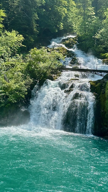
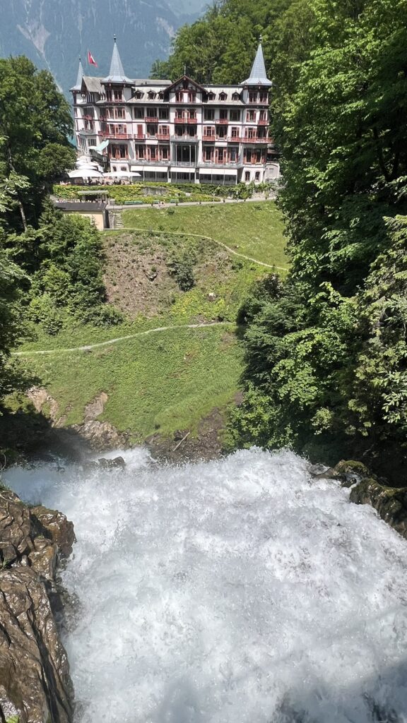
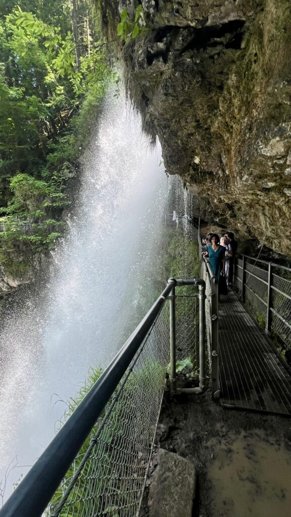
After we landed, we bought tickets to ride the funicular (10 CHF round trip), which takes visitors to the falls and the Grandhotel Giessbach at the top. The ride was 5-6 min long and you can see part of the waterfalls as you ride the funicular. After you get off the funicular and within a few yards of walking, you will see the magnificent falls on the right hand side.
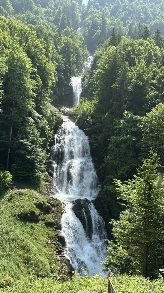
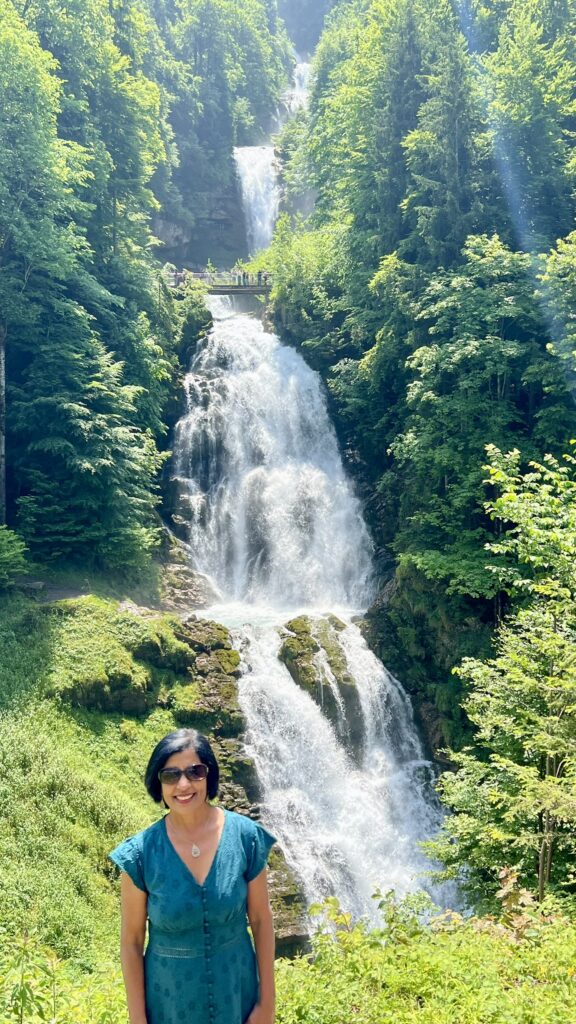
A circular hike from here takes you along the sides of the falls. There are bridges over the falls along the way up to cross over. From these bridges, you can take in the view of the falls and the hotel. One of the bridges also takes you behind one of the cascade.
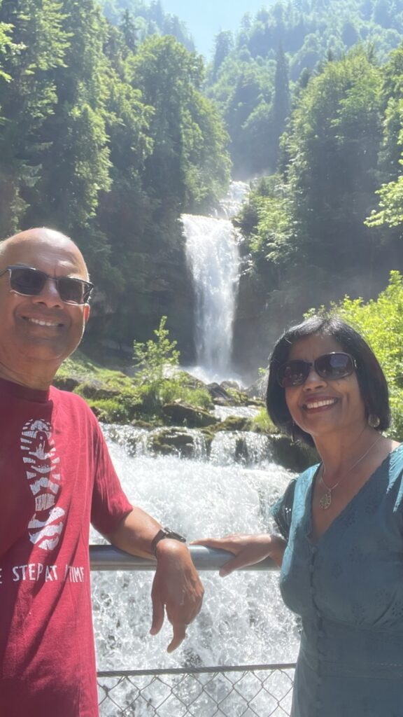
After spending an hour hiking and enjoying the falls from many places, we took the funicular down. I took a video of the falls as we rode the funicular. After we got off the funicular, we walked to a nearby view point from where you can see the falls entering the lake Brienz.
Jungfraujoch, The top of Europe – We skipped visiting this place as you would get a similar experience as travelling to Matterhorn. You can access this place from the town of Grindelwald.
- Train from Interlaken Ost to Grindelwald: 29 minutes;
- At Grindelwald, go to Grindelwald Terminal WAB, which is separate from the main train Grindelwald Station. Take the Eiger Express to Eigergletscher: 20 minutes;
- Eigergletscher to Jungfraujoch on the Jungfraubahn: 26 minutes;
- Total time including transfers: 1 hour 36 minutes
- With Swiss Travel Pass, you get 25% off the total cost which is still $175/person (June 2025)